places in Bolgatanga
Coronavirus disease (COVID-19) Situation
confirmed cases
171889
deaths
1462
Ghana
Bolgatanga
Bolgatanga
Administrative Region:
Upper East Region
population:
68 183
calling code:
+233-38
postcode:
UBXXX
Location on the map of Ghana
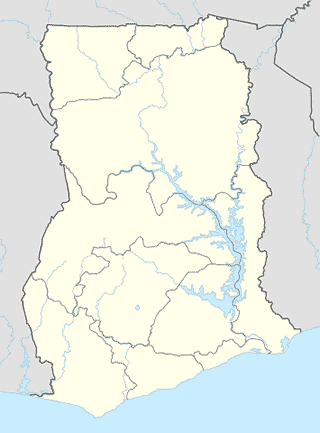
Bolgatanga
Food
The Smoothie Company
Bolgatanga
Food
read more
Gas station
Goil
Tamale - Navrongo, Bolgatanga
Gas station
read more
Mobil Filling Station
Tamale - Navrongo, Bolgatanga
Gas station
read more
Bolga Central Total Service Station
Bolgatanga-Zebilla Road, Bolgatanga
Gas station
read more
Frimps Oil Company Ltd
Tamale - Navrongo
Gas station
read more
Nasona Filling Station
Bolgatanga-Zebilla Road, Bolgatanga
Gas station
read more
GOIL GAS STATION
Bolgatanga
Gas station
read more
BOST Oil Depot
Ghana
Gas station
read more
Grocery or supermarket
Rans Ventures
Bolgatanga-Bongo Road, Bolgatanga
Grocery or supermarket
read more
Rain Inn Supermarket
Commercial Street, Bolgatanga
Grocery or supermarket
read more
Daily Needs
Commercial Street, Bolgatanga
Grocery or supermarket
read more
Hospital
Asankunde Memorial Hospital
Bolgatanga
Hospital
read more
Regional Hospital Mosque
Bolgatanga
Hospital
read more
Rhema Clinic $ Maternity Home
Bolgatanga
Hospital
read more
Hospital Mosque
Bolgatanga
Hospital
read more
BDS Laboratories Ltd. Bolgatanga
opposit municipal police station
Hospital
read more
Afri Kids Medical Centre
Bolgatanga
Hospital
read more
Hospital Chaple, Bolga
Bolgatanga
Hospital
read more
Zuarungu Health Centre
Unnamed Rd
Hospital
read more
Doctors' Flats
Unnamed Rd,, Bolgatanga
Hospital
read more
Bolgatanga Regional Hospital
Zaare,, Bolgatanga
Hospital
read more
Hospital flats
mortuary road, Bolgatanga
Hospital
read more
Amiah Hospital
Bolgatanga
Hospital
read more
BABA AYUU - TRADITIONAL HEALER
Bolgatanga-Navarongo Road, Bolgatanga
Hospital
read more
Plaza Health Centre
Bazaar Road, Bolgatanga
Hospital
read more
Library
Regional Library
Bolgatanga
Library
read more
📑
Bolgatanga all categories
Administrative area level 1
Administrative area level 2
Atm
Bank
Bar
Beauty salon
Book store
Bus station
Cafe
Car repair
Car wash
Church
Clothing store
Electronics store
Finance
Fire station
Food
Gas station
General contractor
Grocery or supermarket
Gym
Health
Hospital
Library
Local government office
Locality
Lodging
Mosque
Neighborhood
Night club
Park
Pharmacy
Place of worship
Point of interest
Police
Post office
Premise
Restaurant
Route
School
Shopping mall
Stadium
Storage
Store
Supermarket
Taxi stand
Travel agency
University
sublocality level 1
↑