Church nearby Peniel Revelation Worship Centre
Ghana
Church nearby Peniel Revelation Worship Centre
Peniel Revelation Worship Centre
Haatso, Ghana
contacts phone
:
+233 24 238 1499
Latitude:
5.676677
, Longitude:
-0.2076446
larger map & directions
read more
nearest Church
8 m
Ascension Methodist Church
Haatso
Church
read more
390 m
Celestial Church of Christ; St Anthony of Padua Parish Ghana
Fourth Avenue, Accra
Church
read more
402 m
Healing Ways Chapel International
AH 245, Achimota
Church
read more
441 m
Healing Ways Chapel International
Dicko Dee Villa, Haatso- Ecomog Near, 1
Church
read more
441 m
Seventh-day Adventist Church, Haatso
Haatso
Church
read more
464 m
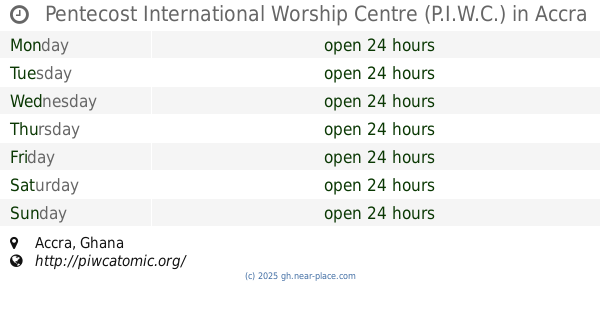
Pentecost International Worship Centre (P.I.W.C.)
Accra
Church
read more
556 m
PEOPLE OF PRAISE CHAPEL,Restoration Assembly
Fourth Avenue, Haatso
Church
read more
586 m
Lighthouse Chapel International Haatso
Unnamed Road, Haatso
Church
read more
618 m
Blessed Redemption Outreach Ministries Int.
Haatso
Church
read more
672 m
Bohye Asaase Prayer Camp
Ghana
Church
read more
678 m
Doxa Citadel
Haatso
Church
read more
688 m
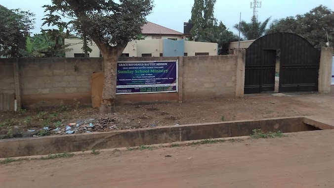
Grace Reformed Baptist Church
Ecomog, Haatso
Church
read more
745 m
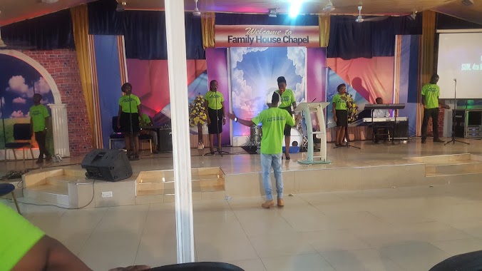
Family House chapel
Ecomog, haatso, Road
Church
read more
754 m
Shalom PRESBY
Haatso
Church
read more
811 m
Transfiguration Anglican Church,Haatso
Haatso
Church
read more
840 m
Haatso Pentecost Church
Haatso
Church
read more
1.32 km
Harris Chapel Baptist Church
Haatso
Church
read more
1.352 km
True Faith Church
Church
read more
1.377 km
GLOBAL REVIVAL MINISTRIES (REVIVAL CITY)
Haatso-Atomic Road, Accra
Church
read more
1.411 km
Perfecting Faith Chapel
Haatso-Atomic Road, Haatso
Church
read more
1.454 km
Abu Gyan 家里Ascension Congregation
Ghana
Church
read more
1.662 km
Super Market Haatso
Haatso-Atomic Road, Accra
Church
read more
1.676 km
Oasis Of Joy International Fellowship
Haatso
Church
read more
1.866 km
Bethesda Methodist Church And School
Agbogba
Church
read more
2.062 km
EP church
Dampoo, Agbogba
Church
read more
📑
all categories
Accounting
Administrative area level 1
Administrative area level 2
Airport
Amusement park
Aquarium
Art gallery
Atm
Bakery
Bank
Bar
Beauty salon
Bicycle store
Book store
Bus station
Cafe
Campground
Car dealer
Car rental
Car repair
Car wash
Casino
Cemetery
Church
City hall
Clothing store
Colloquial area
Convenience store
Courthouse
Dentist
Department store
Doctor
Electrician
Electronics store
Embassy
Finance
Fire station
Florist
Food
Funeral home
Furniture store
Gas station
General contractor
Grocery or supermarket
Gym
Hair care
Hardware store
Health
Hindu Temple
Home goods store
Hospital
Insurance agency
Intersection
Jewelry store
Laundry
Lawyer
Library
Liquor store
Local government office
Locality
Locksmith
Lodging
Meal delivery
Meal takeaway
Mosque
Movie rental
Movie theater
Moving company
Museum
Natural feature
Neighborhood
Night club
Painter
Park
Parking
Pet store
Pharmacy
Physiotherapist
Place of worship
Plumber
Point of interest
Police
Post office
Premise
Real estate agency
Restaurant
Roofing contractor
Route
Rv park, camping
School
Shoe store
Shopping mall
Spa
Stadium
Storage
Store
Subpremise
Subway station
Supermarket
Synagogue
Taxi stand
Train station
Transit station
Travel agency
University
Veterinary care
Zoo
sublocality level 1
↑