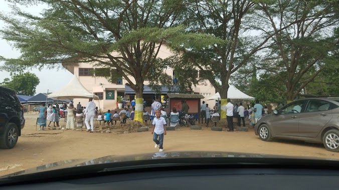
Church nearby Presby, Bethel Congregation
Ghana
Church nearby Presby, Bethel Congregation
Presby, Bethel Congregation
Ga West, Ghana
contacts phone
:
+233
Latitude:
5.6913983
, Longitude:
-0.2879133
larger map & directions
read more
nearest Church
262 m
Winners Chapel International, Pokuase
Church
read more
303 m
LightHouse Chapel, Pokuasi
Nsawam Road, Medie
Church
read more
303 m
LightHouse Chapel, Pokuasi
N6, Medie
Church
read more
352 m
The Church Of Pentecost Pokuase North
Church
read more
372 m
Jewels of God Church
Ghana
Church
read more
551 m
Asofan Assemblies of God, Church
Asofa Avenue
Church
read more
556 m
Bethel Presbyterian
Nsawam Road
Church
read more
572 m
House Of Zion Ministries International
Ghana
Church
read more
631 m
ICGC Gateway Sanctuary
Nsawam Road, Amasaman
Church
read more
801 m
Presbytarian Church-Pokuasi
Ghana
Church
read more
809 m
The Church of Pentecost, Pokuase
Ghana
Church
read more
823 m
Divine Healers Church
Ghana
Church
read more
857 m
The Heirs Ministry
Ghana
Church
read more
891 m
Apostolic Practical Church - Pokuasi
Ghana
Church
read more
946 m
Firehouse Chapel International
Ghana
Church
read more
955 m
Christian Liberation Chapel
Ghana
Church
read more
1.038 km
St. Sylvanus Catholic Church
Ghana
Church
read more
1.092 km
Light House Chapel Pokoasi Aduman
Greater Ga west Pokoase Aduman, Accra
Church
read more
1.115 km
Jehovah's Witnesses Kingdom Hall ,Pokuase
Ghana
Church
read more
1.215 km
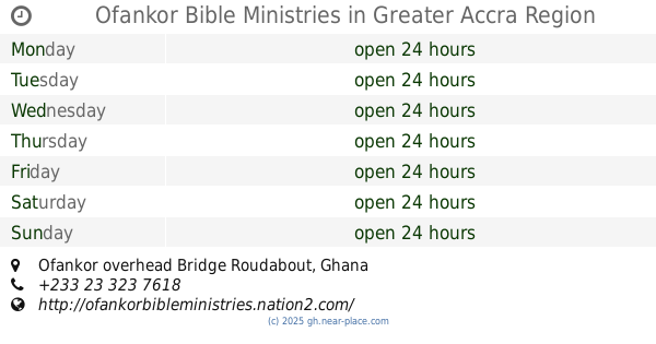
Ofankor Bible Ministries
Ofankor overhead Bridge Roudabout
Church
read more
1.236 km
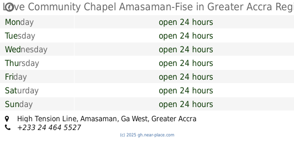
Love Community Chapel Amasaman-Fise
High Tension Line, Amasaman
Church
read more
1.251 km
Pokoase Highway Kingdom Hall
7th Road, Accra
Church
read more
1.637 km
The Church Of Pentecost, Aduman-Assembly
Kwabenya-Pokuase Road
Church
read more
1.825 km
Amanfrom SDA
Church
read more
1.883 km
Church of Christ, Amasaman
Amasaman
Church
read more
📑
all categories
Accounting
Administrative area level 1
Administrative area level 2
Airport
Amusement park
Aquarium
Art gallery
Atm
Bakery
Bank
Bar
Beauty salon
Bicycle store
Book store
Bus station
Cafe
Campground
Car dealer
Car rental
Car repair
Car wash
Casino
Cemetery
Church
City hall
Clothing store
Colloquial area
Convenience store
Courthouse
Dentist
Department store
Doctor
Electrician
Electronics store
Embassy
Finance
Fire station
Florist
Food
Funeral home
Furniture store
Gas station
General contractor
Grocery or supermarket
Gym
Hair care
Hardware store
Health
Hindu Temple
Home goods store
Hospital
Insurance agency
Intersection
Jewelry store
Laundry
Lawyer
Library
Liquor store
Local government office
Locality
Locksmith
Lodging
Meal delivery
Meal takeaway
Mosque
Movie rental
Movie theater
Moving company
Museum
Natural feature
Neighborhood
Night club
Painter
Park
Parking
Pet store
Pharmacy
Physiotherapist
Place of worship
Plumber
Point of interest
Police
Post office
Premise
Real estate agency
Restaurant
Roofing contractor
Route
Rv park, camping
School
Shoe store
Shopping mall
Spa
Stadium
Storage
Store
Subpremise
Subway station
Supermarket
Synagogue
Taxi stand
Train station
Transit station
Travel agency
University
Veterinary care
Zoo
sublocality level 1
↑