Clothing store nearby PKOGH
Ghana
Clothing store nearby PKOGH
PKOGH
Accra Ghana
contacts phone
:
+233
Latitude:
5.5610609
, Longitude:
-0.2653512
read more
nearest Clothing store
185 m
Unicom Mum & Kids
Accra
Clothing store
read more
386 m
Jambel Mother Care
Accra
Clothing store
read more
453 m
Patty Looks Fashion
Sempe Loop, Accra
Clothing store
read more
499 m
Amalena Children's Haven
Tunga, Accra
Clothing store
read more
563 m
Aara's Closet
2nd Street, Accra
Clothing store
read more
569 m
Neighboorhood barbering shop
3rd Road, Accra
Clothing store
read more
581 m
Talk'n Apparel
1st Close, Accra
Clothing store
read more
596 m
Jaycam's Collection
Ghana
Clothing store
read more
618 m
No Problem The Best T-Shirt
Ghana
Clothing store
read more
644 m
Black Velvet Lingerie
Ghana
Clothing store
read more
684 m
Crossgate Boutique
Dansoman High Street, Accra
Clothing store
read more
696 m
Bond Street Boutique
Dansoman Road, Accra
Clothing store
read more
752 m
ekhooks fashion house
Accra
Clothing store
read more
822 m
Kreation 4 Occasions
Dansoman High Street, Accra
Clothing store
read more
823 m
Rosefabricsgh
Dansoman High Street, Accra
Clothing store
read more
846 m
Ken and Eu shop
Dansoman, Accra
Clothing store
read more
850 m
In God We Trust Ayor Baby Baby Kenkey Boutique
Ghana
Clothing store
read more
850 m
Big Eden Baby Care
Tunga, Accra
Clothing store
read more
881 m
Joebell's Boutique
Dansoman High Street, Accra
Clothing store
read more
909 m
Yawa Clothing
Ghana
Clothing store
read more
931 m
Suzette Beauty Palour
Accra
Clothing store
read more
942 m
Clothing Focus
A 909/17 Dansoman Estates, Accra
Clothing store
read more
962 m
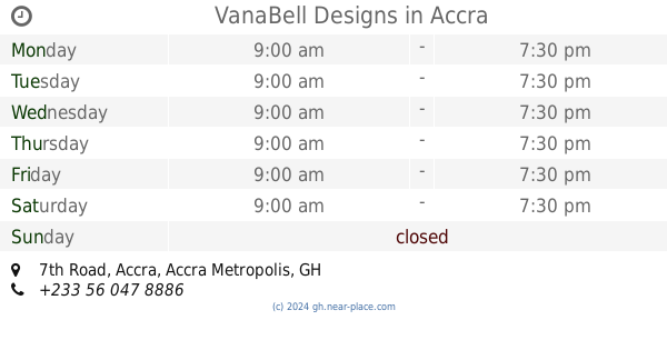
VanaBell Designs
5°33'08.7"N 0°15'54., 7th Road, Accra
Clothing store
read more
1.043 km
Justbark Fashion
Accra
Clothing store
read more
1.082 km
QUOPHI AKOTUAH GHANA
Dansoman High Street, Accra Dansoman
Clothing store
read more
📑
all categories
Accounting
Administrative area level 1
Administrative area level 2
Airport
Amusement park
Aquarium
Art gallery
Atm
Bakery
Bank
Bar
Beauty salon
Bicycle store
Book store
Bus station
Cafe
Campground
Car dealer
Car rental
Car repair
Car wash
Casino
Cemetery
Church
City hall
Clothing store
Colloquial area
Convenience store
Courthouse
Dentist
Department store
Doctor
Electrician
Electronics store
Embassy
Finance
Fire station
Florist
Food
Funeral home
Furniture store
Gas station
General contractor
Grocery or supermarket
Gym
Hair care
Hardware store
Health
Hindu Temple
Home goods store
Hospital
Insurance agency
Intersection
Jewelry store
Laundry
Lawyer
Library
Liquor store
Local government office
Locality
Locksmith
Lodging
Meal delivery
Meal takeaway
Mosque
Movie rental
Movie theater
Moving company
Museum
Natural feature
Neighborhood
Night club
Painter
Park
Parking
Pet store
Pharmacy
Physiotherapist
Place of worship
Plumber
Point of interest
Police
Post office
Premise
Real estate agency
Restaurant
Roofing contractor
Route
Rv park, camping
School
Shoe store
Shopping mall
Spa
Stadium
Storage
Store
Subpremise
Subway station
Supermarket
Synagogue
Taxi stand
Train station
Transit station
Travel agency
University
Veterinary care
Zoo
sublocality level 1
↑