Places in Dome
Language
❭
Spain
Polish
German
Denmark
Open map
Ghana
Dome
Local time:
21:33:00
Dome
Administrative Region:
Greater Accra Region
Population:
84 904
Calling code:
+233-30
Postcode:
GE000-GExxx
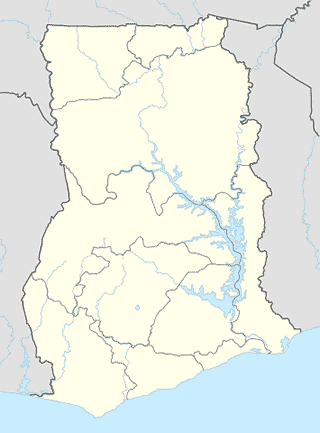
Location on the map of Ghana
Dome
Accra
Accra
Locality
Political
Read more
El'Orr Castle Hotel and The Jazz Court
314-315
Lodging
Point of interest
Establishment
Read more
Calabash Green Executive Apartments
House No. 69, Westlands Boulevard West - Accra, Accra
Lodging
Point of interest
Establishment
Read more
Secret Hotel
4 Cedar Road, (Pillar 2), Accra
Lodging
Point of interest
Establishment
Read more
Holy Trinity Guesthouse
Riverside, Accra
Lodging
Point of interest
Establishment
Read more
University of Ghana, Legon
Legon Boundary, Accra
University
Point of interest
Establishment
Read more
GWS Online GH - Ghana Web Solutions Online
POB MS280, Achimota Mile 7
Point of interest
Establishment
Read more
Internet Place
Parakuo Estates, Accra
Point of interest
Establishment
Read more
Consort Supermarket
West Legon, Accra
Supermarket
Grocery or supermarket
Store
Food
Point of interest
Establishment
Read more
Easy Track Ghana, Ltd.
Dome Pillar 2, Kwasi Oppong Junction
Point of interest
Establishment
Read more
Kunte Kinte Gardens
Kwabenya
Point of interest
Establishment
Read more
Lou-Ralph Hotel
Accra
Lodging
Point of interest
Establishment
Read more
Dokua Royal Hotel
ACP, Pokoasi-Kwabenya Road، Accra
Lodging
Point of interest
Establishment
Read more
Al Muntada Al Islami
Kwabenya
Mosque
Place of worship
Point of interest
Establishment
Read more
Afenyowu Ventures
Kwabenya
Point of interest
Establishment
Read more
Achimota School
Achimota
School
Point of interest
Establishment
Read more
Goil Fuel Station
Ghana
Point of interest
Establishment
Read more
Ghana Institute of Management and Public Administration (GIMPA)
Greenhill, Accra
University
Point of interest
Establishment
Read more
Staff Resource Center
J.K.M. Hodasi Road, Accra
Point of interest
Establishment
Read more
North Legon
North Legon
sublocality level 1
Sublocality
Political
Read more
📑
Dome all categories
Accounting
Administrative area level 1
Administrative area level 2
Airport
Amusement park
Aquarium
Art gallery
Atm
Bakery
Bank
Bar
Beauty salon
Bicycle store
Book store
Bowling alley
Bus station
Cafe
Campground
Car dealer
Car rental
Car repair
Car wash
Casino
Cemetery
Church
City hall
Clothing store
Colloquial area
Convenience store
Country
Courthouse
Dentist
Department store
Doctor
Electrician
Electronics store
Embassy
Establishment
Finance
Fire station
Florist
Food
Funeral home
Furniture store
Gas station
General contractor
Grocery or supermarket
Gym
Hair care
Hardware store
Health
Hindu Temple
Home goods store
Hospital
Insurance agency
Intersection
Jewelry store
Laundry
Lawyer
Library
Light rail station
Liquor store
Local government office
Locality
Locksmith
Lodging
Meal delivery
Meal takeaway
Mosque
Movie rental
Movie theater
Moving company
Museum
Natural feature
Neighborhood
Night club
Painter
Park
Parking
Pet store
Pharmacy
Physiotherapist
Place of worship
Plumber
Point of interest
Police
Political
Post office
Premise
Real estate agency
Restaurant
Roofing contractor
Route
Rv park, camping
School
Shoe store
Shopping mall
Spa
Stadium
Storage
Store
Sublocality
Subpremise
Subway station
Supermarket
Synagogue
Taxi stand
Train station
Transit station
Travel agency
University
Veterinary care
Zoo
administrative area level 3
administrative area level 4
administrative area level 5
sublocality level 1
sublocality level 2
sublocality level 3
sublocality level 4
↑