Health nearby Espana Pharmacy
Coronavirus disease (COVID-19) Situation
confirmed cases
171889
deaths
1462
Ghana
Health nearby Espana Pharmacy
Espana Pharmacy
Mataheko Emef goil filling station, Afienya Ghana
contacts phone
:
+233
Latitude:
5.7578018
, Longitude:
-0.0047733
read more
nearest Health
3.25 km
Adom Herbal
Tema
Health
read more
3.256 km
Heights Pharmacy
Sebrepor
Health
read more
3.606 km
Bethel retreat centre
Bediako Saki road
Health
read more
4.02 km
dbsaki
5°43'45.5"N 0°01'03., 4th Avenue, Accra
Health
read more
5.119 km
Micro Health Laboratories
Unnamed Road, Tema
Health
read more
5.55 km
THEONIC PHARMACY
Tema
Health
read more
6.085 km
Healings Pharmacy
Unnamed Road, Tema
Health
read more
6.852 km
Dampong Medical Centre
Unnamed Road, Tema
Health
read more
7.814 km
Ernest Chemists Ltd
16/17, Tema
Health
read more
8.01 km
Maridav Ghana Limited
Tema
Health
read more
8.039 km
Widama Pharmaceutical
Ashaiman, Tema
Health
read more
8.534 km
Ekuus pharmacy
Tema
Health
read more
9.553 km
Top Pill Pharmacy
Community Eight, Tema
Health
read more
11.101 km
Salem Eye Centre
Tema
Health
read more
12.415 km
Maple Mart Pharmacy
Tema
Health
read more
13.303 km
Ernes Chemist Factory
Metropolitan Amezion Church,, Krakue Road, Tema
Health
read more
14.63 km
Nolan Pharmacy ltd
West Boundary Road community 18, Tema
Health
read more
14.946 km
Julie Dee Pharmacy
Ashaley Botwe
Health
read more
15.803 km
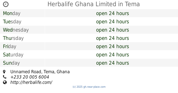
Herbalife Ghana Limited
Unnamed Road, Tema
Health
read more
15.947 km
Malikem Pharmacy
P. O. Box 0, Trassaco Roundabout Leading Zoomloin Office, Accra
Health
read more
16.071 km
Trust Clinic
Sakumono
Health
read more
16.987 km
Health Allianz Clinic & Pharmacy
ET Akonor Street, Adjirigano-Botwe Rd, Within Top Oil Filling Station, Greater, Accra
Health
read more
17.172 km
PhysioWorld Physiotherapy & Rehabilitation Center.
Health
read more
17.191 km
DANADAMS PHARMACEUTICAL INDUSTRY GHANA LIMITED
67 Nungua Link, Spintex Road, Accra
Health
read more
18.706 km
Rinat Clinic
Adjiringanor, Madina
Health
read more
📑
all categories
Accounting
Administrative area level 1
Administrative area level 2
Airport
Amusement park
Aquarium
Art gallery
Atm
Bakery
Bank
Bar
Beauty salon
Bicycle store
Book store
Bus station
Cafe
Campground
Car dealer
Car rental
Car repair
Car wash
Casino
Cemetery
Church
City hall
Clothing store
Colloquial area
Convenience store
Courthouse
Dentist
Department store
Doctor
Electrician
Electronics store
Embassy
Finance
Fire station
Florist
Food
Funeral home
Furniture store
Gas station
General contractor
Grocery or supermarket
Gym
Hair care
Hardware store
Health
Hindu Temple
Home goods store
Hospital
Insurance agency
Intersection
Jewelry store
Laundry
Lawyer
Library
Liquor store
Local government office
Locality
Locksmith
Lodging
Meal delivery
Meal takeaway
Mosque
Movie rental
Movie theater
Moving company
Museum
Natural feature
Neighborhood
Night club
Painter
Park
Parking
Pet store
Pharmacy
Physiotherapist
Place of worship
Plumber
Point of interest
Police
Post office
Premise
Real estate agency
Restaurant
Roofing contractor
Route
Rv park, camping
School
Shoe store
Shopping mall
Spa
Stadium
Storage
Store
Subpremise
Subway station
Supermarket
Synagogue
Taxi stand
Train station
Transit station
Travel agency
University
Veterinary care
Zoo
sublocality level 1
↑