Lodging nearby Detemple Hotel
Ghana
Lodging nearby Detemple Hotel
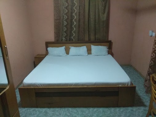
Detemple Hotel
Ghana
contacts phone
:
+233
Latitude:
5.6240605
, Longitude:
-0.2471468
larger map & directions
read more
nearest Lodging
133 m
Reeelux Lodge
1 Five Avenue , 16th Street Community 18 spuntex road, Accra
Lodging
read more
297 m
Kings Premier Lodge
16th Street New, Achimota
Lodging
read more
480 m
Akokoraba Hostel
Ghana
Lodging
read more
505 m
Hotel Caledonian Ltd
Ghana
Lodging
read more
612 m
Milton Hotel
Nii Okaiman West Main Road
Lodging
read more
624 m
Fatiros Lodge
Nii Okaiman East
Lodging
read more
649 m
Vitara Hotel
Ghana
Lodging
read more
682 m
Kinsby Hotel
Ghana
Lodging
read more
705 m
Daisy Hotel Amenities Company Limited
Ghana
Lodging
read more
742 m
Sun Splash Hotel
Accra
Lodging
read more
784 m
Jekus Guest House
Sarabande Road, Achimota
Lodging
read more
812 m
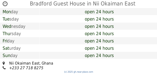
Bradford Guest House
Nii Okaiman East
Lodging
read more
848 m
Maple leaf hotel ltd
Obodoi Street, Achimota
Lodging
read more
861 m
Maple Leaf Hotel Ghana
Accra Metropolis
Lodging
read more
864 m
La Cle Dor Hotel
Ghana
Lodging
read more
869 m
Korkdam Hotel Hotel
8 Korkdam Avenue, New Achimota, Accra
Lodging
read more
869 m
Korkdam Hotel
8 Korkdam Avenue, New Achimota, Accra
Lodging
read more
896 m
Wassa hotel
Ghana
Lodging
read more
987 m
Mountain Guest Limited
Ghana
Lodging
read more
1.04 km
Telecentre Guesthouse
Mile 7, New Achimota, Achimota
Lodging
read more
1.237 km
Lincoln Hotel
Kinsby Junction, Neoplan station, Achimota
Lodging
read more
1.301 km
BROWN HOSTEL
Akweteyman
Lodging
read more
1.472 km
Vanderpuye's Lodge
Pumpkin Avenue, Accra
Lodging
read more
1.634 km
Alligator Guesthouse
H/N 07, LAPAZ OKOKROKO JUNCTION, new market H/N 07, LAPAZ OKOKROKO JUNCTION, new market, Lapaz
Lodging
read more
2.424 km
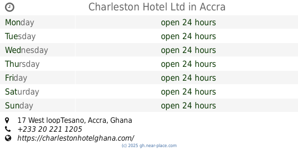
Charleston Hotel Ltd
17 West loopTesano, Accra
Lodging
read more
📑
all categories
Accounting
Administrative area level 1
Administrative area level 2
Airport
Amusement park
Aquarium
Art gallery
Atm
Bakery
Bank
Bar
Beauty salon
Bicycle store
Book store
Bus station
Cafe
Campground
Car dealer
Car rental
Car repair
Car wash
Casino
Cemetery
Church
City hall
Clothing store
Colloquial area
Convenience store
Courthouse
Dentist
Department store
Doctor
Electrician
Electronics store
Embassy
Finance
Fire station
Florist
Food
Funeral home
Furniture store
Gas station
General contractor
Grocery or supermarket
Gym
Hair care
Hardware store
Health
Hindu Temple
Home goods store
Hospital
Insurance agency
Intersection
Jewelry store
Laundry
Lawyer
Library
Liquor store
Local government office
Locality
Locksmith
Lodging
Meal delivery
Meal takeaway
Mosque
Movie rental
Movie theater
Moving company
Museum
Natural feature
Neighborhood
Night club
Painter
Park
Parking
Pet store
Pharmacy
Physiotherapist
Place of worship
Plumber
Point of interest
Police
Post office
Premise
Real estate agency
Restaurant
Roofing contractor
Route
Rv park, camping
School
Shoe store
Shopping mall
Spa
Stadium
Storage
Store
Subpremise
Subway station
Supermarket
Synagogue
Taxi stand
Train station
Transit station
Travel agency
University
Veterinary care
Zoo
sublocality level 1
↑