Lodging nearby Lucky Lodge And Pub
Ghana
Lodging nearby Lucky Lodge And Pub
Lucky Lodge And Pub
North Kaneshi, Accra Ghana
contacts phone
:
+233
Latitude:
5.5858573
, Longitude:
-0.234762
read more
nearest Lodging
229 m
Swan Hotel
Accra
Lodging
read more
257 m
Hotel Evans-Q
Kaakatsofa Street, Accra
Lodging
read more
358 m
Hotel Adodo
Abele Street, Accra
Lodging
read more
761 m
Flo Homes
27 Mukose Street, Accra
Lodging
read more
814 m
Talenthouse
Tafo Amon Street, Accra
Lodging
read more
873 m
Queen Ruby Kourt
Abeka, Accra
Lodging
read more
890 m
Luxury Boutique Bed and Breakfast
Accra
Lodging
read more
901 m
Krama Hotel
Accra
Lodging
read more
907 m
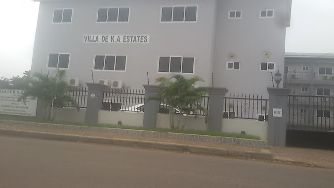
Villa De K.A. Estate
Otu Street, Accra
Lodging
read more
930 m
MKNG Trading Ltd.
First Mukose Link, Accra
Lodging
read more
955 m
Orgle Lodge
Orgle Road, Accra
Lodging
read more
957 m
Winning Faith Ministry
North Kaneshie, Mukose Street, Accra
Lodging
read more
991 m
Venaco lodge
Tantra Street, Accra
Lodging
read more
1.059 km
Akyirem Guest House and Lodge
North Kaneshie, Near the St Theresa School, North Kaneshi
Lodging
read more
1.059 km
Hotel de Sapporo (North Kaneshie)
Otinkorang Street, Accra
Lodging
read more
1.066 km
Acacia Guest Lodge North Kaneshie
P.O.Box 11492, Accra
Lodging
read more
1.071 km
Bizkits Palace
Orgle Rd, Accra, Accra
Lodging
read more
1.11 km
加纳_阿克拉鑫源旅馆
Orgle Road, Accra
Lodging
read more
1.131 km
Lux Palace Hotel
First Orgle Link, Accra
Lodging
read more
1.245 km
Royal Atlantic Hostel
Palace Street, Accra
Lodging
read more
1.318 km
Legacy hotel
Fotoli Lane, Accra
Lodging
read more
1.69 km
Suncity Hotel
Sun City, hotel near
Lodging
read more
1.699 km
GTUC International Students'Hostel
Tesano, Accra
Lodging
read more
1.908 km
Hotel Zeus
Nsawam Road, Accra
Lodging
read more
2.727 km
Commordor's
Onyankle Street, Accra
Lodging
read more
📑
all categories
Accounting
Administrative area level 1
Administrative area level 2
Airport
Amusement park
Aquarium
Art gallery
Atm
Bakery
Bank
Bar
Beauty salon
Bicycle store
Book store
Bus station
Cafe
Campground
Car dealer
Car rental
Car repair
Car wash
Casino
Cemetery
Church
City hall
Clothing store
Colloquial area
Convenience store
Courthouse
Dentist
Department store
Doctor
Electrician
Electronics store
Embassy
Finance
Fire station
Florist
Food
Funeral home
Furniture store
Gas station
General contractor
Grocery or supermarket
Gym
Hair care
Hardware store
Health
Hindu Temple
Home goods store
Hospital
Insurance agency
Intersection
Jewelry store
Laundry
Lawyer
Library
Liquor store
Local government office
Locality
Locksmith
Lodging
Meal delivery
Meal takeaway
Mosque
Movie rental
Movie theater
Moving company
Museum
Natural feature
Neighborhood
Night club
Painter
Park
Parking
Pet store
Pharmacy
Physiotherapist
Place of worship
Plumber
Point of interest
Police
Post office
Premise
Real estate agency
Restaurant
Roofing contractor
Route
Rv park, camping
School
Shoe store
Shopping mall
Spa
Stadium
Storage
Store
Subpremise
Subway station
Supermarket
Synagogue
Taxi stand
Train station
Transit station
Travel agency
University
Veterinary care
Zoo
sublocality level 1
↑