Lodging nearby Onayaa Hotel
Ghana
Lodging nearby Onayaa Hotel
Onayaa Hotel
Amasaman, Toman Just before Agyia Appiah Bitters., Amasaman, Ghana
contacts phone
:
+233 24 479 0110
website:
travel.jumia.com
Latitude:
5.7146587
, Longitude:
-0.305226
larger map & directions
read more
nearest Lodging
1.007 km
Goshen Villa
Amasaman
Lodging
read more
1.38 km
Vanguard Enclave
Amasaman
Lodging
read more
1.637 km
Love and Unity Guesthouse
OdumaseTransformer, Opposite the Mosque Pokuase Ga West
Lodging
read more
1.65 km
A & T Hotel
Amasaman
Lodging
read more
1.665 km
CKK Lodge
Anyway Taxi Rank, Amasaman
Lodging
read more
1.666 km
Apple Leaf Hotel
Ghana
Lodging
read more
1.706 km
Hotel de Belfort, Afiaman
Ghana
Lodging
read more
1.714 km
Ramie's
Ga East
Lodging
read more
1.728 km
Firm Foundation Boys' Hostel
Lodging
read more
1.892 km
Wachild Estate
Ghana
Lodging
read more
2.135 km
Hans Hotel
Ghana
Lodging
read more
2.189 km
Joy Family Lodge
Fise Junction, Pokuase-Amasaman Road (Opp. the Catholic Church), Accra
Lodging
read more
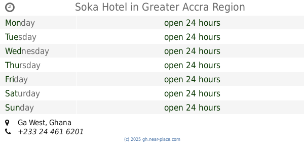
2.299 km
Soka Hotel
Lodging
read more
2.369 km
Eric Nana sanctuary
Ink Avenue, Amasaman
Lodging
read more
2.399 km
Lakisha hotel
Ghana
Lodging
read more
2.409 km
MAYERA NEWLIFE
Lodging
read more
2.446 km
Duodu De Ville
Achiaman
Lodging
read more
2.903 km
Silverdoor Hotel
Lodging
read more
2.976 km
Nayewa Guest House
Ghana
Lodging
read more
3.014 km
NAYEWA HESSEN LODGE
N1
Lodging
read more
3.092 km
Festus Hotel
Nsawam Road
Lodging
read more
3.184 km
Topido Hotel
Ghana
Lodging
read more
3.327 km
Delali Guest House
Ghana
Lodging
read more
4.679 km
Legassi Gardens Apt
#4 Addis Avenue,, Holy Hills, Pokuase Junction,, POKUASE, Greater Accra Region, Accra
Lodging
read more
4.968 km
Dokua Royal Hotel
Kwabenya, Kwabenyan
Lodging
read more
📑
all categories
Accounting
Administrative area level 1
Administrative area level 2
Airport
Amusement park
Aquarium
Art gallery
Atm
Bakery
Bank
Bar
Beauty salon
Bicycle store
Book store
Bus station
Cafe
Campground
Car dealer
Car rental
Car repair
Car wash
Casino
Cemetery
Church
City hall
Clothing store
Colloquial area
Convenience store
Courthouse
Dentist
Department store
Doctor
Electrician
Electronics store
Embassy
Finance
Fire station
Florist
Food
Funeral home
Furniture store
Gas station
General contractor
Grocery or supermarket
Gym
Hair care
Hardware store
Health
Hindu Temple
Home goods store
Hospital
Insurance agency
Intersection
Jewelry store
Laundry
Lawyer
Library
Liquor store
Local government office
Locality
Locksmith
Lodging
Meal delivery
Meal takeaway
Mosque
Movie rental
Movie theater
Moving company
Museum
Natural feature
Neighborhood
Night club
Painter
Park
Parking
Pet store
Pharmacy
Physiotherapist
Place of worship
Plumber
Point of interest
Police
Post office
Premise
Real estate agency
Restaurant
Roofing contractor
Route
Rv park, camping
School
Shoe store
Shopping mall
Spa
Stadium
Storage
Store
Subpremise
Subway station
Supermarket
Synagogue
Taxi stand
Train station
Transit station
Travel agency
University
Veterinary care
Zoo
sublocality level 1
↑