Lodging nearby Queenstar Court B
Ghana
Lodging nearby Queenstar Court B
Queenstar Court B
23, Odotei Tsui Street, Accra, Accra Metropolis, GH Ghana
contacts phone
:
+233
Latitude:
5.610808
, Longitude:
-0.1998195
larger map & directions
read more
nearest Lodging
217 m
Essland Hotel
19 Osu Badu Street, Accra
Lodging
read more
279 m
Portions Bar & Motel
23 TETTE QUAYE STREET DZORWULU LAST CHANCE, Accra
Lodging
read more
395 m
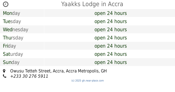
Yaakks Lodge
Owusu Tetteh Street, Accra
Lodging
read more
412 m
Alloysius Villa
Dzorwulu, Accra
Lodging
read more
426 m
Ayinka Villa
1st Tettehkwel Street, Accra
Lodging
read more
548 m
Liberty Courts
Roman Ridge, Accra
Lodging
read more
551 m
Relax Court Hotel
47 Nii Noi Kwame street Dzorwulu N1 extension road, Accra
Lodging
read more
564 m
The Avery Apartments
3 Nii Bonnie Close Max Mart, Accra
Lodging
read more
676 m
Omanye Lodge Guesthouse
8, Bia Street, Dzorwulu, Accra
Lodging
read more
717 m
Sam's luxury Apartments
Accra
Lodging
read more
726 m
Lady In Red, Roman Ridge
Accra
Lodging
read more
727 m
Hillview Hotel
Ghana, Accra
Lodging
read more
741 m
Nogahill Hotel
Accra
Lodging
read more
741 m
Nogahill Hotel
28 Ninth Road, Accra
Lodging
read more
742 m
Earl Heights Suites Hotel
Tetteh Kwei Street, Accra
Lodging
read more
753 m
Earl Heights Suites Hotel
No. 10, Tetteh Kwei Street, Dzorwulu
Lodging
read more
785 m
Rex Court Hotel
North Dzorwulu, Accra
Lodging
read more
807 m
Imperial Lodge
Sir Emmanuel Quist Street, Accra
Lodging
read more
810 m
Continental Plaza Hotel Dzorwulu
Nii Nortei Nyanchie Street, Accra
Lodging
read more
1.005 km
Asanko guest house
Roman Ridge, 10 Quarcoo lane, Accra
Lodging
read more
1.022 km
Sam's Cottage
27 Odum Road, North Dzorwulu Off Tetter Quarshie - Achimota N1 Highway, Accra
Lodging
read more
1.061 km
Kotobabi Ebony
1st Kotobabi link, Accra
Lodging
read more
1.143 km
Holiday Hotel
Dzorwulu, Accra
Lodging
read more
1.286 km
Fiesta Royale Hotel Hotel
Motorway Extension, Accra
Lodging
read more
1.299 km
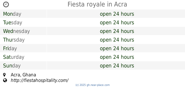
Fiesta royale
Accra
Lodging
read more
📑
all categories
Accounting
Administrative area level 1
Administrative area level 2
Airport
Amusement park
Aquarium
Art gallery
Atm
Bakery
Bank
Bar
Beauty salon
Bicycle store
Book store
Bus station
Cafe
Campground
Car dealer
Car rental
Car repair
Car wash
Casino
Cemetery
Church
City hall
Clothing store
Colloquial area
Convenience store
Courthouse
Dentist
Department store
Doctor
Electrician
Electronics store
Embassy
Finance
Fire station
Florist
Food
Funeral home
Furniture store
Gas station
General contractor
Grocery or supermarket
Gym
Hair care
Hardware store
Health
Hindu Temple
Home goods store
Hospital
Insurance agency
Intersection
Jewelry store
Laundry
Lawyer
Library
Liquor store
Local government office
Locality
Locksmith
Lodging
Meal delivery
Meal takeaway
Mosque
Movie rental
Movie theater
Moving company
Museum
Natural feature
Neighborhood
Night club
Painter
Park
Parking
Pet store
Pharmacy
Physiotherapist
Place of worship
Plumber
Point of interest
Police
Post office
Premise
Real estate agency
Restaurant
Roofing contractor
Route
Rv park, camping
School
Shoe store
Shopping mall
Spa
Stadium
Storage
Store
Subpremise
Subway station
Supermarket
Synagogue
Taxi stand
Train station
Transit station
Travel agency
University
Veterinary care
Zoo
sublocality level 1
↑