Lodging nearby Stevenstas guesthouse
Ghana
Lodging nearby Stevenstas guesthouse
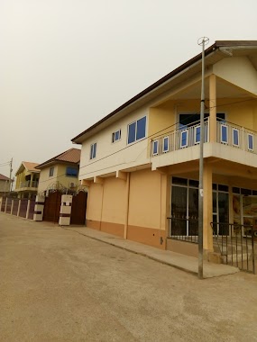
Stevenstas guesthouse
Nungua Central, Accra, Ghana
contacts phone
:
+233 30 272 1907
Latitude:
5.6136265
, Longitude:
-0.083584
larger map & directions
read more
nearest Lodging
279 m
Wolton Guest House
Adogon 2nd close house nr.7, Buade Rd, Nungua, Accra
Lodging
read more
410 m
Jarov Lodge
7110th Avenue Extension, Nungua Central
Lodging
read more
432 m
Jetrico Hotel
Nungua Central, Accra
Lodging
read more
472 m
loyalty International hostel
25 Nungua buade, Accra
Lodging
read more
494 m
Lexis Lodge Guest House
Nungua Buade junction, Accra
Lodging
read more
546 m
Italian Guest House
Nungua Central, Accra
Lodging
read more
553 m
Classic Guest House
Nungua Central, Accra
Lodging
read more
631 m
Marinette Hotel
Nungua, Near Lekma Polyclinic And Maranatha Mission Church, Addogono, Accra
Lodging
read more
737 m
Loyalty Hotel
25 avenue Buade, Adogon-Buade road, Accra
Lodging
read more
774 m
Kormens Hotel
Accra
Lodging
read more
786 m
Nungua Ravico Industry
Unnamed Road, Accra
Lodging
read more
791 m
VVB Hse
J256/, 6th Avenue, Accra
Lodging
read more
865 m
Royal Ravico Hotel
Nungua, Accra
Lodging
read more
925 m
Wiselink Lodge Guest House & Budget Accommodation
Baatsonaa, Accra
Lodging
read more
969 m
SKAN Guest House
Accra
Lodging
read more
1.024 km
Kormens Hotel & Services
Unnamed Road, Accra
Lodging
read more
1.026 km
Lord Apartments (Regimanuel Gray Estate)
Nungua Barrirer, Nungua Central
Lodging
read more
1.115 km
Biney's Hotel Apartments
10th Avenue, Accra
Lodging
read more
1.267 km
Skan Guest House
A-14 Comm 15 Tema, Tema
Lodging
read more
1.542 km
Provemat Guest House
Ghana
Lodging
read more
1.594 km
New Life Nungua Childrens Home
Accra
Lodging
read more
1.907 km
C. Tellier Guest House
200 feet from Premicsa Hotel., Accra
Lodging
read more
1.945 km
Joh Ann Western Guest House
Mokwe Street, Accra
Lodging
read more
2.277 km
Riklyn Hotel
Accra
Lodging
read more
2.546 km
Stevlee Poconos Hotel
Accra
Lodging
read more
📑
all categories
Accounting
Administrative area level 1
Administrative area level 2
Airport
Amusement park
Aquarium
Art gallery
Atm
Bakery
Bank
Bar
Beauty salon
Bicycle store
Book store
Bus station
Cafe
Campground
Car dealer
Car rental
Car repair
Car wash
Casino
Cemetery
Church
City hall
Clothing store
Colloquial area
Convenience store
Courthouse
Dentist
Department store
Doctor
Electrician
Electronics store
Embassy
Finance
Fire station
Florist
Food
Funeral home
Furniture store
Gas station
General contractor
Grocery or supermarket
Gym
Hair care
Hardware store
Health
Hindu Temple
Home goods store
Hospital
Insurance agency
Intersection
Jewelry store
Laundry
Lawyer
Library
Liquor store
Local government office
Locality
Locksmith
Lodging
Meal delivery
Meal takeaway
Mosque
Movie rental
Movie theater
Moving company
Museum
Natural feature
Neighborhood
Night club
Painter
Park
Parking
Pet store
Pharmacy
Physiotherapist
Place of worship
Plumber
Point of interest
Police
Post office
Premise
Real estate agency
Restaurant
Roofing contractor
Route
Rv park, camping
School
Shoe store
Shopping mall
Spa
Stadium
Storage
Store
Subpremise
Subway station
Supermarket
Synagogue
Taxi stand
Train station
Transit station
Travel agency
University
Veterinary care
Zoo
sublocality level 1
↑