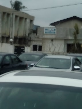
Lodging nearby sunny coast hotel
Ghana
Lodging nearby sunny coast hotel
sunny coast hotel
Unnamed Rd Ghana
contacts phone
:
+233
Latitude:
5.565005
, Longitude:
-0.3522562
read more
nearest Lodging
1.807 km
Ultimate Hotel
Mile 11
Lodging
read more
1.839 km
Adia Guest House
Old Barrier, Weija, Ga West
Lodging
read more
2.062 km
Peace Palace Westhills Estate
Weija Broadcasting
Lodging
read more
2.237 km
Best Choice Hotel
New Bortianor, Weija
Lodging
read more
2.267 km
Ricks hostel
Accra
Lodging
read more
2.275 km
behind Gracelove Pharmacy
off New Bortianor main road
Lodging
read more
2.47 km
Ikem Guest House
SCC Junction, Weija
Lodging
read more
2.547 km
Manglad Hotel
Accra - Cape Coast Road
Lodging
read more
2.567 km
Aat Hotel
Accra - Cape Coast Road
Lodging
read more
2.676 km
Konadu Guest House
Ghana
Lodging
read more
2.699 km
Eurospin Hotel
N.14 Old Barrier, Bread Road, off the Kasoa-Weija Road, beside King Mirror, Weija
Lodging
read more
2.763 km
KB Lodge
Ghana
Lodging
read more
2.828 km
Napoli Lodge
Unnamed Road
Lodging
read more
2.937 km
Cheers Guesthouse
36 Accra - Cape Coast Road, Ngleshi Amanfro
Lodging
read more
2.979 km
The New Hostel
opposite Rick Naa hostel
Lodging
read more
3.009 km
Blue Lodge Guest House
Opposite Gateway (COP) CP Road, Vodafone Interchange, Kasoa
Lodging
read more
3.035 km
Jamaica Inn Guest House
Silverbird Weija Cinema, Accra - Cape Coast Road, Accra
Lodging
read more
3.329 km
Ghana Vacation House
Lodging
read more
3.438 km
CHEQUERS LODGE
Lodging
read more
3.443 km
Bay View Hotel
Ghana
Lodging
read more
3.457 km
Elimens Lodge (Guest House)
Atta Mills Road, Ga West
Lodging
read more
3.5 km
Denish Hotel
Ghana
Lodging
read more
3.943 km
Escrow Guesthouse
Behind King's University, New Aplaku, Off Kokrobite Beach Road, Kokrobite
Lodging
read more
4.021 km
Crown Liberty Hotel
Ghana
Lodging
read more
4.024 km
Guest House
Ghana
Lodging
read more
📑
all categories
Accounting
Administrative area level 1
Administrative area level 2
Airport
Amusement park
Aquarium
Art gallery
Atm
Bakery
Bank
Bar
Beauty salon
Bicycle store
Book store
Bus station
Cafe
Campground
Car dealer
Car rental
Car repair
Car wash
Casino
Cemetery
Church
City hall
Clothing store
Colloquial area
Convenience store
Courthouse
Dentist
Department store
Doctor
Electrician
Electronics store
Embassy
Finance
Fire station
Florist
Food
Funeral home
Furniture store
Gas station
General contractor
Grocery or supermarket
Gym
Hair care
Hardware store
Health
Hindu Temple
Home goods store
Hospital
Insurance agency
Intersection
Jewelry store
Laundry
Lawyer
Library
Liquor store
Local government office
Locality
Locksmith
Lodging
Meal delivery
Meal takeaway
Mosque
Movie rental
Movie theater
Moving company
Museum
Natural feature
Neighborhood
Night club
Painter
Park
Parking
Pet store
Pharmacy
Physiotherapist
Place of worship
Plumber
Point of interest
Police
Post office
Premise
Real estate agency
Restaurant
Roofing contractor
Route
Rv park, camping
School
Shoe store
Shopping mall
Spa
Stadium
Storage
Store
Subpremise
Subway station
Supermarket
Synagogue
Taxi stand
Train station
Transit station
Travel agency
University
Veterinary care
Zoo
sublocality level 1
↑