Lodging nearby Union Hostel
Ghana
Lodging nearby Union Hostel
Union Hostel
Asene Avenue, Accra, Accra Metropolis, GH Ghana
contacts phone
:
+233
Latitude:
5.6500642
, Longitude:
-0.2055306
larger map & directions
read more
nearest Lodging
275 m
Bakana Hostels
29 Manu Avenue, Accra
Lodging
read more
316 m
Haven hostel
Accra
Lodging
read more
365 m
Expo Hostels
Baiden Avenue 2nd Street, Accra
Lodging
read more
440 m
King's Court Hostel
West Legon, Accra
Lodging
read more
448 m
Linda Dor Hostel
61 Westlands Boulevard, Accra
Lodging
read more
486 m
Bakana Hostels
West Legon, Accra
Lodging
read more
520 m
Calabash Green Executive Apartments
House No 69, Westlands Boulevard, West Legon., Accra
Lodging
read more
534 m
Downtown Hotel
Communication Junction, Dolphine Drive, West Legon
Lodging
read more
594 m
Agu Lodge
Atomic Road, Haatso
Lodging
read more
601 m
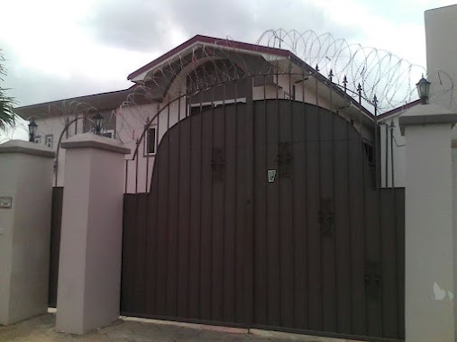
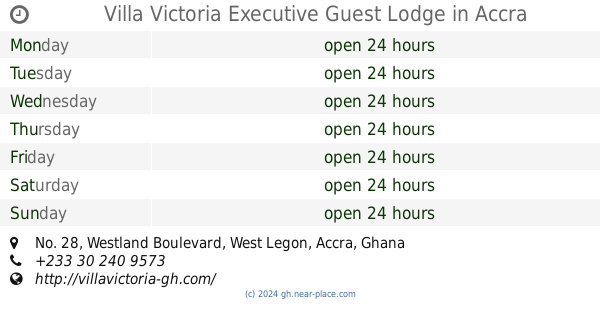
Villa Victoria Executive Guest Lodge
No. 28, Westland Boulevard, West Legon, Accra
Lodging
read more
613 m
Villa Victoria Executive Guest Lodge
West Legon, 28 Westlands Boulevard, Accra
Lodging
read more
818 m
Downtown Hotel West Legon
Nii Annan Lane, Accra
Lodging
read more
821 m
Royal Palm Groove Lodge
West Legon, Accra
Lodging
read more
829 m
Olive Heights Hotel
19 Ga Mashie Road, street
Lodging
read more
953 m
Pokua Plaza
Second St.K. Asante Avenue, Accra
Lodging
read more
972 m
Friendly Hostel
Accra
Lodging
read more
987 m
Sky Bright Hotel
Haatso Main Road, West Legon
Lodging
read more
1.047 km
Justa Hotel
New Legon Accra Accra
Lodging
read more
1.183 km
Bakana Hostel Annex
Accra
Lodging
read more
1.196 km
S.A. MENSA'S COURT
West Legon, Accra
Lodging
read more
1.2 km
OscarPak Royal Hotel
Accra
Lodging
read more
1.292 km
Olive Guest House
Accra
Lodging
read more
1.421 km
Senior Common Room
commonwealth hall
Lodging
read more
1.864 km
Legon Hall Annex C (GRADUATE HOSTEL)
Barimah Road, Accra
Lodging
read more
2.143 km
Power Plaza Hostel
5Th Street, Accra
Lodging
read more
📑
all categories
Accounting
Administrative area level 1
Administrative area level 2
Airport
Amusement park
Aquarium
Art gallery
Atm
Bakery
Bank
Bar
Beauty salon
Bicycle store
Book store
Bus station
Cafe
Campground
Car dealer
Car rental
Car repair
Car wash
Casino
Cemetery
Church
City hall
Clothing store
Colloquial area
Convenience store
Courthouse
Dentist
Department store
Doctor
Electrician
Electronics store
Embassy
Finance
Fire station
Florist
Food
Funeral home
Furniture store
Gas station
General contractor
Grocery or supermarket
Gym
Hair care
Hardware store
Health
Hindu Temple
Home goods store
Hospital
Insurance agency
Intersection
Jewelry store
Laundry
Lawyer
Library
Liquor store
Local government office
Locality
Locksmith
Lodging
Meal delivery
Meal takeaway
Mosque
Movie rental
Movie theater
Moving company
Museum
Natural feature
Neighborhood
Night club
Painter
Park
Parking
Pet store
Pharmacy
Physiotherapist
Place of worship
Plumber
Point of interest
Police
Post office
Premise
Real estate agency
Restaurant
Roofing contractor
Route
Rv park, camping
School
Shoe store
Shopping mall
Spa
Stadium
Storage
Store
Subpremise
Subway station
Supermarket
Synagogue
Taxi stand
Train station
Transit station
Travel agency
University
Veterinary care
Zoo
sublocality level 1
↑