Pharmacy nearby Amasaman Community Pharmacy
Coronavirus disease (COVID-19) Situation
confirmed cases
171889
deaths
1462
Ghana
Pharmacy nearby Amasaman Community Pharmacy
Amasaman Community Pharmacy
Amasaman, Ghana
contacts phone
:
+233
Latitude:
5.7053796
, Longitude:
-0.2996014
larger map & directions
read more
nearest Pharmacy
566 m
BFK Pharmacy
Amasaman
Pharmacy
read more
569 m
KAMGA chemical shop
Hse No.15, Amasaman
Pharmacy
read more
737 m
Drug Store
Amasaman
Pharmacy
read more
1.161 km
Janet Chemical Shop
Pharmacy
read more
1.393 km
Trafford Pharmacy
Abease
Pharmacy
read more
2.017 km
Andrews Agyei Brefo CHEMIST
Pharmacy
read more
2.06 km
Health Kit Pharmacy
Ghana
Pharmacy
read more
2.224 km
Yaw Bediako Chemical Store
Ghana
Pharmacy
read more
2.614 km
Greener D. N. Awuku Chemist
Ghana
Pharmacy
read more
2.657 km
Carlton House Pharmacy
Ga, West
Pharmacy
read more
2.986 km
Absolute Health Pharmacy Ltd.
Pokuase Greater Region, New Road, Accra
Pharmacy
read more
3.544 km
Rodina Chemist
Pharmacy
read more
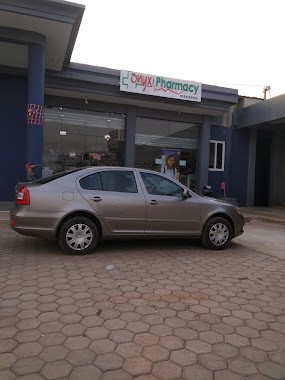
4.367 km
Onyx Pharmacy
Pharmacy
read more
4.796 km
Immaculate Pharmacy
Ghana
Pharmacy
read more
4.957 km
WILLY 'G' RETAIL PHARMACY
Kwabenya
Pharmacy
read more
5.386 km
Leticia Aryee Pharmacy
Pharmacy
read more
8.251 km
Danslob Pharmacy Limited
Pharmacy
read more
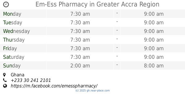
10.352 km
Em-Ess Pharmacy
Ghana
Pharmacy
read more
10.429 km
Gina Chemicals Shop
Pharmacy
read more
13.003 km
Radiance Pharmacy
Ghana
Pharmacy
read more
13.416 km
Dufie Chemicals
Accra
Pharmacy
read more
14.445 km
Pharmacy Metropharm Ltd.
Gbawe Road
Pharmacy
read more
14.815 km
24/7 Mother-Love Pharmacy
Adenta Municipality
Pharmacy
read more
17.769 km
Prime Pharmacy
Accra
Pharmacy
read more
17.979 km
Rayoni Pharmacy
Tumu, Ave
Pharmacy
read more
📑
all categories
Accounting
Administrative area level 1
Administrative area level 2
Airport
Amusement park
Aquarium
Art gallery
Atm
Bakery
Bank
Bar
Beauty salon
Bicycle store
Book store
Bus station
Cafe
Campground
Car dealer
Car rental
Car repair
Car wash
Casino
Cemetery
Church
City hall
Clothing store
Colloquial area
Convenience store
Courthouse
Dentist
Department store
Doctor
Electrician
Electronics store
Embassy
Finance
Fire station
Florist
Food
Funeral home
Furniture store
Gas station
General contractor
Grocery or supermarket
Gym
Hair care
Hardware store
Health
Hindu Temple
Home goods store
Hospital
Insurance agency
Intersection
Jewelry store
Laundry
Lawyer
Library
Liquor store
Local government office
Locality
Locksmith
Lodging
Meal delivery
Meal takeaway
Mosque
Movie rental
Movie theater
Moving company
Museum
Natural feature
Neighborhood
Night club
Painter
Park
Parking
Pet store
Pharmacy
Physiotherapist
Place of worship
Plumber
Point of interest
Police
Post office
Premise
Real estate agency
Restaurant
Roofing contractor
Route
Rv park, camping
School
Shoe store
Shopping mall
Spa
Stadium
Storage
Store
Subpremise
Subway station
Supermarket
Synagogue
Taxi stand
Train station
Transit station
Travel agency
University
Veterinary care
Zoo
sublocality level 1
↑