Pharmacy nearby Vynne Pharmacy
Coronavirus disease (COVID-19) Situation
confirmed cases
171889
deaths
1462
Ghana
Pharmacy nearby Vynne Pharmacy
Vynne Pharmacy
Ghana
contacts phone
:
+233 30 250 3906
Latitude:
5.6879822
, Longitude:
-0.1712511
larger map & directions
read more
nearest Pharmacy
433 m
Pharmacy
Wu-Biibi Lane, Madina
Pharmacy
read more
434 m
Fobiq Pharmacy
Ritz Road, Adenta
Pharmacy
read more
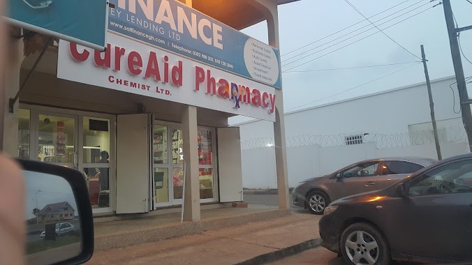
494 m
CureAid Pharmacy
Adenta, Adenta,Accra
Pharmacy
read more
531 m
Telad Pharmacy
Ghana
Pharmacy
read more
744 m
Betvin Pharmacy
Legon East Road, Madina
Pharmacy
read more
1.136 km
Mal-Titi Chemists Ltd. Day & Night Dispensing Chemist
Ghana
Pharmacy
read more
1.143 km
Samah Chemist
N4, Madina
Pharmacy
read more
1.222 km
Maliko Pharma Ltd.
Ghana
Pharmacy
read more
1.305 km
PillPoint Pharmacy - Adenta (Wholesale)
Ghana
Pharmacy
read more
1.343 km
Randy Pharmacy
Madina
Pharmacy
read more
1.647 km
CLINISERVE PHARMACY
Ecowas Road, Madina
Pharmacy
read more
1.647 km
Caads Pharmacy
Madina
Pharmacy
read more
1.967 km
Abby Pharma Ltd
Ghana
Pharmacy
read more
1.996 km
Olives Chemists Pharmacy
Ghana
Pharmacy
read more
2.29 km
Kemida Pharmacy
Westland Boulevard Road, Madina
Pharmacy
read more
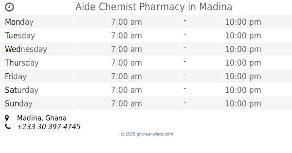
2.358 km
Aide Chemist Pharmacy
Madina
Pharmacy
read more
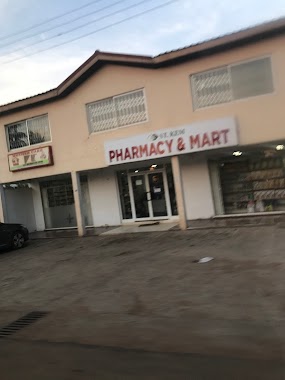
2.504 km
St Kem Pharmacy and Mart
Pharmacy
read more
2.615 km
Pharmacy
Agbogba - Ashongman Road
Pharmacy
read more
2.798 km
Emerald Pharmacy
Ghana
Pharmacy
read more
2.837 km
Radiance Pharmacy
Ghana
Pharmacy
read more
2.898 km
Cardinal Chemist
Madina
Pharmacy
read more
2.975 km
Randy Pharmacy Limited
Boundary Road, Madina
Pharmacy
read more
3.032 km
Aviation Road Pharmacy
66 Ayaben St, Adenta Municipality
Pharmacy
read more
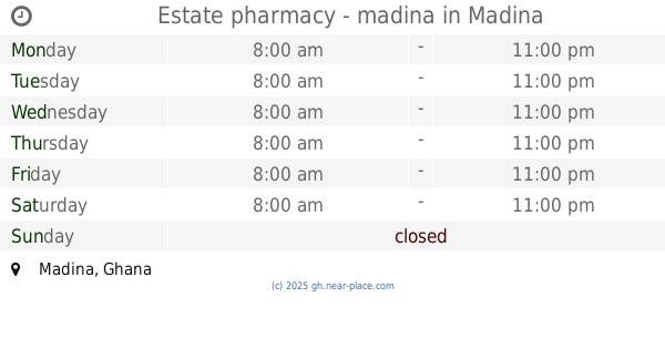
3.121 km
Estate pharmacy - madina
Madina
Pharmacy
read more
3.731 km
CS Allot Pharmacy
Haatso-Atomic Road, Haatso
Pharmacy
read more
📑
all categories
Accounting
Administrative area level 1
Administrative area level 2
Airport
Amusement park
Aquarium
Art gallery
Atm
Bakery
Bank
Bar
Beauty salon
Bicycle store
Book store
Bus station
Cafe
Campground
Car dealer
Car rental
Car repair
Car wash
Casino
Cemetery
Church
City hall
Clothing store
Colloquial area
Convenience store
Courthouse
Dentist
Department store
Doctor
Electrician
Electronics store
Embassy
Finance
Fire station
Florist
Food
Funeral home
Furniture store
Gas station
General contractor
Grocery or supermarket
Gym
Hair care
Hardware store
Health
Hindu Temple
Home goods store
Hospital
Insurance agency
Intersection
Jewelry store
Laundry
Lawyer
Library
Liquor store
Local government office
Locality
Locksmith
Lodging
Meal delivery
Meal takeaway
Mosque
Movie rental
Movie theater
Moving company
Museum
Natural feature
Neighborhood
Night club
Painter
Park
Parking
Pet store
Pharmacy
Physiotherapist
Place of worship
Plumber
Point of interest
Police
Post office
Premise
Real estate agency
Restaurant
Roofing contractor
Route
Rv park, camping
School
Shoe store
Shopping mall
Spa
Stadium
Storage
Store
Subpremise
Subway station
Supermarket
Synagogue
Taxi stand
Train station
Transit station
Travel agency
University
Veterinary care
Zoo
sublocality level 1
↑