School nearby Destiny Child School
Ghana
School nearby Destiny Child School
Destiny Child School
Achimota Ghana
contacts phone
:
+233
Latitude:
5.6220145
, Longitude:
-0.2329683
read more
nearest School
61 m
Victory Preparatory School
Ghana
School
read more
296 m
Timeline Trust, Accra
No. 104 Otsaame Baako Lane, Pumpkin Ave, Achimota Neoplan, Near Jerusalem Restaurant, Achimota, Accra
School
read more
419 m
Eagle Vision Institute
School
read more
439 m
Lilliput School
Azumah Junction, Accra
School
read more
441 m
Words And Figures With Christ International School
New-Achimota, St. Fisher street, House number 25, Accra
School
read more
458 m
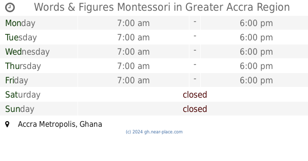
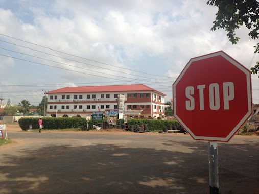
Words & Figures Montessori
School
read more
470 m
Frus Academy
Ghana
School
read more
473 m
Delsi Kids
Ghana
School
read more
544 m
St.John's Barlingua Preparatory School
Ghana
School
read more
602 m
The Falsyd Foundation School. Pre-School, Primary & JHS
Ghana
School
read more
623 m
Grace and Glory Preparatory School
Ghana
School
read more
684 m
Anglican School Park
Akweteyman
School
read more
710 m
Gh Media School
Accra
School
read more
757 m
iSoft Training Experience Center
Accra
School
read more
761 m
HoF Vilac International School
Accra
School
read more
783 m
Golden Foundation School
Accra Metropolis
School
read more
791 m
Living God Preparatory School
Akweteyman
School
read more
835 m
Adom Academy
Accra
School
read more
962 m
Glory Child Academy
Accra
School
read more
963 m
Little Roses And Tulips International School
Akweteyman
School
read more
1.025 km
Abofu Presby Basic school
Accra
School
read more
1.064 km
Mount Horeb Prep/JHS
Abofu Park, Accra, Greater Accra
School
read more
1.154 km
Asiamah Memorial School
Akweteyman
School
read more
1.314 km
RAMA SCHOOL
Akweteyman
School
read more
1.874 km
Unto Others International School, Abeka
Church Street, Accra
School
read more
📑
all categories
Accounting
Administrative area level 1
Administrative area level 2
Airport
Amusement park
Aquarium
Art gallery
Atm
Bakery
Bank
Bar
Beauty salon
Bicycle store
Book store
Bus station
Cafe
Campground
Car dealer
Car rental
Car repair
Car wash
Casino
Cemetery
Church
City hall
Clothing store
Colloquial area
Convenience store
Courthouse
Dentist
Department store
Doctor
Electrician
Electronics store
Embassy
Finance
Fire station
Florist
Food
Funeral home
Furniture store
Gas station
General contractor
Grocery or supermarket
Gym
Hair care
Hardware store
Health
Hindu Temple
Home goods store
Hospital
Insurance agency
Intersection
Jewelry store
Laundry
Lawyer
Library
Liquor store
Local government office
Locality
Locksmith
Lodging
Meal delivery
Meal takeaway
Mosque
Movie rental
Movie theater
Moving company
Museum
Natural feature
Neighborhood
Night club
Painter
Park
Parking
Pet store
Pharmacy
Physiotherapist
Place of worship
Plumber
Point of interest
Police
Post office
Premise
Real estate agency
Restaurant
Roofing contractor
Route
Rv park, camping
School
Shoe store
Shopping mall
Spa
Stadium
Storage
Store
Subpremise
Subway station
Supermarket
Synagogue
Taxi stand
Train station
Transit station
Travel agency
University
Veterinary care
Zoo
sublocality level 1
↑