School nearby EastBank School Complex
Ghana
School nearby EastBank School Complex
EastBank School Complex
Oyibi Ghana
contacts phone
:
+233
Latitude:
5.7932364
, Longitude:
-0.1260172
read more
nearest School
555 m
School Of Business Valley View University
Columbia Road
School
read more
695 m
Baobab Centre, VVU
School
read more
699 m
Baobab Center
Columbia Road
School
read more
784 m
Institute of Computer Science
Ghana
School
read more
785 m
Computer Science Department Valley View University
Tema
School
read more
792 m
Valley View University Basic School
School
read more
794 m
VVU Basic School Administration
School
read more
871 m
Seth laryea multi-purpose Center
School
read more
1.035 km
NASDA
Jj Nortey-Cafeteria Road
School
read more
1.257 km
Broad Daylight International School
Ghana
School
read more
1.332 km
Ghana Christian University College
Ghana
School
read more
1.337 km
High Hopes School
Ghana
School
read more
1.485 km
School administration
School
read more
1.527 km
Haavad Senior High School
Ghana
School
read more
1.884 km
Pearl Of Africa Montessori
Ghana
School
read more
2.482 km
Accra Grammar School
Oyibi
School
read more
2.55 km
Immaculate Conception School
School
read more
2.562 km
Oyibi Presby School
Oyibi
School
read more
3.173 km
Amrahia Community School
Amrahia
School
read more
3.318 km
The Banner School
Oyibi
School
read more
3.716 km
Danfa Methodist JHS
School
read more
6.662 km
Bible School
Ghana
School
read more
6.683 km
Manak School Complex
Ghana
School
read more
12.157 km
Mount Eye International School
Greater, Accra Region
School
read more
17.963 km
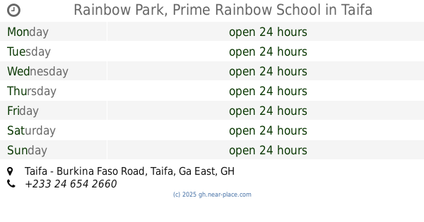
Rainbow Park, Prime Rainbow School
Taifa - Burkina Faso Road, Taifa
School
read more
📑
all categories
Accounting
Administrative area level 1
Administrative area level 2
Airport
Amusement park
Aquarium
Art gallery
Atm
Bakery
Bank
Bar
Beauty salon
Bicycle store
Book store
Bus station
Cafe
Campground
Car dealer
Car rental
Car repair
Car wash
Casino
Cemetery
Church
City hall
Clothing store
Colloquial area
Convenience store
Courthouse
Dentist
Department store
Doctor
Electrician
Electronics store
Embassy
Finance
Fire station
Florist
Food
Funeral home
Furniture store
Gas station
General contractor
Grocery or supermarket
Gym
Hair care
Hardware store
Health
Hindu Temple
Home goods store
Hospital
Insurance agency
Intersection
Jewelry store
Laundry
Lawyer
Library
Liquor store
Local government office
Locality
Locksmith
Lodging
Meal delivery
Meal takeaway
Mosque
Movie rental
Movie theater
Moving company
Museum
Natural feature
Neighborhood
Night club
Painter
Park
Parking
Pet store
Pharmacy
Physiotherapist
Place of worship
Plumber
Point of interest
Police
Post office
Premise
Real estate agency
Restaurant
Roofing contractor
Route
Rv park, camping
School
Shoe store
Shopping mall
Spa
Stadium
Storage
Store
Subpremise
Subway station
Supermarket
Synagogue
Taxi stand
Train station
Transit station
Travel agency
University
Veterinary care
Zoo
sublocality level 1
↑