School nearby Methodist Kemp School
Ghana
School nearby Methodist Kemp School
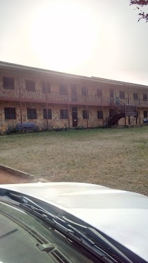
Methodist Kemp School
Aburi Ghana
contacts phone
:
+233
Latitude:
5.8421915
, Longitude:
-0.1739252
read more
nearest School
237 m
Aburi Methodist Primary Scool
Aburi
School
read more
399 m
Aburi Girls Senior High School Annex
Aburi
School
read more
807 m
Aburi Girls Main Campus
Staff Bungalow 1, Josiah Tongoogari Link, Accra
School
read more
4.45 km
Beacon International School
Ollenu Road Peduase
School
read more
7.203 km
Valley View University Basic School
School
read more
10.382 km
Manak School Complex
Ghana
School
read more
10.477 km
Ashesi Engineering Block
1 University Avenue
School
read more
11.259 km
WIN-WIN Driving School
Ashiyie
School
read more
11.51 km
Penfield Primary School
no, 8 Penfield Rd, Brighton
School
read more
11.883 km
BETS Montessori School
Pantang Abokobi Road, Adenta Municipality
School
read more
11.971 km
The Royal School
Ghana
School
read more
12.185 km
Agape International Academy
Pantang West
School
read more
13.039 km
Gracefield Montessori School
Unnamed Road
School
read more
13.135 km
HighCity Church (BREAKTHROUGH CHAPEL)
School
read more
13.237 km
Tuskegee International School Ghana
Adenta Municipality
School
read more
13.275 km
Afi International School
Afi International, Frafraha, Adenta Municipality
School
read more
13.313 km
Doboro Presby Basic School
Akwane-Doboro, Nsawam
School
read more
13.992 km
Pantang Hospital Junior Secondary School
Adenta Municipality
School
read more
14.646 km
Golden Gate International School
Adenta Municipality
School
read more
14.931 km
Shine International School
Ashongman-Abokobi Road
School
read more
16.26 km
Hillview Momtessori School
Ghana
School
read more
17.818 km
BORN TO WIN ACADEMY
Metropolitan, Tema
School
read more
18.136 km
UST Academy
zenu UST Academy
School
read more
19.539 km
Watford Montesori
Ghana
School
read more
19.653 km
Ashma,2 Basic School.
Tema
School
read more
📑
all categories
Accounting
Administrative area level 1
Administrative area level 2
Airport
Amusement park
Aquarium
Art gallery
Atm
Bakery
Bank
Bar
Beauty salon
Bicycle store
Book store
Bus station
Cafe
Campground
Car dealer
Car rental
Car repair
Car wash
Casino
Cemetery
Church
City hall
Clothing store
Colloquial area
Convenience store
Courthouse
Dentist
Department store
Doctor
Electrician
Electronics store
Embassy
Finance
Fire station
Florist
Food
Funeral home
Furniture store
Gas station
General contractor
Grocery or supermarket
Gym
Hair care
Hardware store
Health
Hindu Temple
Home goods store
Hospital
Insurance agency
Intersection
Jewelry store
Laundry
Lawyer
Library
Liquor store
Local government office
Locality
Locksmith
Lodging
Meal delivery
Meal takeaway
Mosque
Movie rental
Movie theater
Moving company
Museum
Natural feature
Neighborhood
Night club
Painter
Park
Parking
Pet store
Pharmacy
Physiotherapist
Place of worship
Plumber
Point of interest
Police
Post office
Premise
Real estate agency
Restaurant
Roofing contractor
Route
Rv park, camping
School
Shoe store
Shopping mall
Spa
Stadium
Storage
Store
Subpremise
Subway station
Supermarket
Synagogue
Taxi stand
Train station
Transit station
Travel agency
University
Veterinary care
Zoo
sublocality level 1
↑