School nearby New Faith Int. Sch.
Ghana
School nearby New Faith Int. Sch.
New Faith Int. Sch.
Sowutoum Ghana
contacts phone
:
+233
Latitude:
5.6307284
, Longitude:
-0.2728786
read more
nearest School
217 m
Jamverson Academy
Sowutoum
School
read more
344 m
Liberty Preparatory School
School
read more
407 m
ROSSY (CRECHE AND NURSERY)
Sowutoum
School
read more
523 m
Adu Gyamfi. Preparatory School
Sowutuom, Accra
School
read more
525 m
INTENSE remedial College
Isreal park
School
read more
540 m
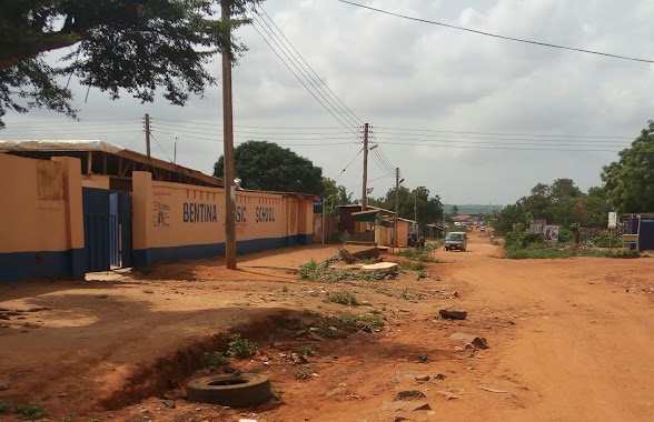
Bentina Basic School
Sowutoum
School
read more
628 m
Phearson Pharmacy Sowutuom
Sowutoum
School
read more
686 m
St'Georges International School
School
read more
711 m
Grace Vocation
Ghana
School
read more
753 m
Phersons Health College
Lomnava Bus Stop, Ga Central Municipal Assembly
School
read more
859 m
Brain Birds Academy
Israel
School
read more
861 m
Liberty School
New, Achimota
School
read more
904 m
Golden Life International School
Lomnava
School
read more
945 m
GHANA COLLEGE SENIOR HIGH TECHNICAL SCHOOL
COLLEGE, Sowutoum
School
read more
962 m
St. Paul's Catholic Seminary
Sowutoum
School
read more
1.019 km
St BB INTERNATIONAL SCHOOL
Blackberry Street, Takoradi
School
read more
1.028 km
Ansarudeen Islamic School
Nii, Okaiman West
School
read more
1.059 km
Angels Nest Preschool
Sowutoum
School
read more
1.081 km
The Living Spring Schools
Nii Okaiman West
School
read more
1.083 km
Kids Alliance Education Centre Yellow House
School
read more
1.105 km
Pentecost University Junction
University Drive
School
read more
1.235 km
Camborg Academy
Nii Okaiman West
School
read more
1.235 km
Ewusiwah Internation School
Acacia Loop, Nii Okaiman West
School
read more
1.28 km
Bethel C.D School
Metropolis, Accra
School
read more
1.285 km
Liver Rose International School
Ghana
School
read more
📑
all categories
Accounting
Administrative area level 1
Administrative area level 2
Airport
Amusement park
Aquarium
Art gallery
Atm
Bakery
Bank
Bar
Beauty salon
Bicycle store
Book store
Bus station
Cafe
Campground
Car dealer
Car rental
Car repair
Car wash
Casino
Cemetery
Church
City hall
Clothing store
Colloquial area
Convenience store
Courthouse
Dentist
Department store
Doctor
Electrician
Electronics store
Embassy
Finance
Fire station
Florist
Food
Funeral home
Furniture store
Gas station
General contractor
Grocery or supermarket
Gym
Hair care
Hardware store
Health
Hindu Temple
Home goods store
Hospital
Insurance agency
Intersection
Jewelry store
Laundry
Lawyer
Library
Liquor store
Local government office
Locality
Locksmith
Lodging
Meal delivery
Meal takeaway
Mosque
Movie rental
Movie theater
Moving company
Museum
Natural feature
Neighborhood
Night club
Painter
Park
Parking
Pet store
Pharmacy
Physiotherapist
Place of worship
Plumber
Point of interest
Police
Post office
Premise
Real estate agency
Restaurant
Roofing contractor
Route
Rv park, camping
School
Shoe store
Shopping mall
Spa
Stadium
Storage
Store
Subpremise
Subway station
Supermarket
Synagogue
Taxi stand
Train station
Transit station
Travel agency
University
Veterinary care
Zoo
sublocality level 1
↑