School nearby Riis Memorial School
Ghana
School nearby Riis Memorial School
Riis Memorial School
Akwei Bu, Accra, Ghana
contacts phone
:
+233
Latitude:
5.5616713
, Longitude:
-0.2576336
larger map & directions
read more
nearest School
209 m
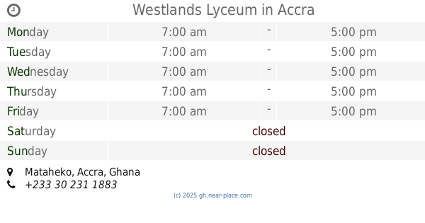
Westlands Lyceum
Mataheko, Accra
School
read more
249 m
Dansoman SDA Nursery and Preparatory School
Mataheko, Accra
School
read more
254 m
Eden Montessori School
Eden Montessori Dansoman
School
read more
304 m
MARS Business College
2nd Ponpon Street, Accra
School
read more
334 m
Most Holy Heart School
Accra
School
read more
348 m
Victory International School
Mataheko, Accra
School
read more
432 m
Libelt School Of Fashion
1st Dansoman Link, Accra
School
read more
503 m
Step by Step Montessori School
Dansoman, Accra
School
read more
680 m
RisdanTech Training School
Accra
School
read more
744 m
MATHAEKO MACEDONIA PRESBYTERIAN CHURCH
Accra
School
read more
751 m
Home Care School
4th Drive, Accra
School
read more
765 m
St Martin de Porres School
Dansoman High Street, Accra
School
read more
766 m
Vertie Day Care
Mataheko, Accra
School
read more
777 m
Mercy Kiddy Montessori Centre
Oblogo Road, Accra
School
read more
790 m
christ ambassador school
6th Close, Accra
School
read more
830 m
ACES Ghana
6th Close Cosmos street, 6th Close, Accra
School
read more
835 m
Tina Kids
mataheko
School
read more
868 m
Newman Preparatory School
Accra
School
read more
922 m
OMG STUDIO
Odorkor, Accra
School
read more
947 m
Odorkor MacLean Junior High School
Odorkor, Accra
School
read more
969 m
Debest Remedial School
Accra
School
read more
978 m
Wesley Grammar Senior High School
Accra
School
read more
1.011 km
Gamath Academy
Dansoman High Street, Accra
School
read more
1.029 km
EKGS Dansoman
5th Cl, Accra, Accra
School
read more
1.036 km
May's Educational Centre
Accra
School
read more
📑
all categories
Accounting
Administrative area level 1
Administrative area level 2
Airport
Amusement park
Aquarium
Art gallery
Atm
Bakery
Bank
Bar
Beauty salon
Bicycle store
Book store
Bus station
Cafe
Campground
Car dealer
Car rental
Car repair
Car wash
Casino
Cemetery
Church
City hall
Clothing store
Colloquial area
Convenience store
Courthouse
Dentist
Department store
Doctor
Electrician
Electronics store
Embassy
Finance
Fire station
Florist
Food
Funeral home
Furniture store
Gas station
General contractor
Grocery or supermarket
Gym
Hair care
Hardware store
Health
Hindu Temple
Home goods store
Hospital
Insurance agency
Intersection
Jewelry store
Laundry
Lawyer
Library
Liquor store
Local government office
Locality
Locksmith
Lodging
Meal delivery
Meal takeaway
Mosque
Movie rental
Movie theater
Moving company
Museum
Natural feature
Neighborhood
Night club
Painter
Park
Parking
Pet store
Pharmacy
Physiotherapist
Place of worship
Plumber
Point of interest
Police
Post office
Premise
Real estate agency
Restaurant
Roofing contractor
Route
Rv park, camping
School
Shoe store
Shopping mall
Spa
Stadium
Storage
Store
Subpremise
Subway station
Supermarket
Synagogue
Taxi stand
Train station
Transit station
Travel agency
University
Veterinary care
Zoo
sublocality level 1
↑