places in Sekondi-Takoradi
Ghana
Sekondi-Takoradi
Sekondi-Takoradi
Administrative Region:
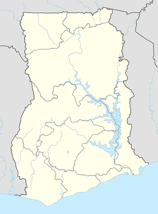
Western Region
population:
445 205
calling code:
+233-31
postcode:
WS000-WS792
Location on the map of Ghana
Sekondi-Takoradi
Police
Eaaikado Police St
Annam Street, Sekondi-Takoradi
Police
read more
Regional Police Headquarters
Sekondi-Takoradi
Police
read more
Post office
Sekondi Post Office
Sekondi-Takoradi
Post office
read more
Premise
Kingdom Hall of Jehovah's Witneses, Ketan Congregation
Sekondi-Takoradi
Premise
read more
Sekondi Central Prison
Sekondi-Takoradi
Premise
read more
Town Hall
Sekondi-Takoradi
Premise
read more
First Digital TV Transmission
Ghana
Premise
read more
GNAT Hall
Ghana
Premise
read more
Connan Hill
Sekondi-Takoradi
Premise
read more
Church of Pentecost Adiembra Assembly
Sekondi-Takoradi
Premise
read more
Esi Quagraines Residence
Sekondi-Takoradi
Premise
read more
Fort George
Sekondi-Takoradi
Premise
read more
Ebenezer Methodist Church, Ketan
Sekondi-Takoradi
Premise
read more
St Theresa's
Essikado
Premise
read more
Mr. S.O Amoah's Residence
Sekondi-Takoradi
Premise
read more
Railway Quarters, Ketan
Sekondi-Takoradi
Premise
read more
Mother Care Apartments
Sekondi-Takoradi
Premise
read more
Nyame Yie Cold Store
Sekondi-Takoradi
Premise
read more
Restaurant
Quagis Food Joint And Catering Services
Sekondi-Takoradi
Restaurant
read more
ALCANTARA PUB
Sekondi-Takoradi
Restaurant
read more
Bourgainvillea African Bar And Restaurant
Sekondi-Takoradi
Restaurant
read more
Chrisking Restaurant
Mercer Street, Sekondi-Takoradi
Restaurant
read more
Turkish Kebab
Essei Street, Sekondi-Takoradi
Restaurant
read more
Pizza Hut on matties in champaign
905, Busy Avenue, Sekondi-Takoradi
Restaurant
read more
Sister Sala's Fast Food
Sekondi-Takoradi
Restaurant
read more
Shopping mall
THEO'S BUSINESS CENTER
Ohen Nketsia Avenue, Essikado
Shopping mall
read more
ENSO NYAME YE/JKT ELECT.& MULTI SHOP-KOJOKROM
Cape Coast - Takoradi Road, Sekondi-Takoradi
Shopping mall
read more
📑
Sekondi-Takoradi all categories
Administrative area level 2
Atm
Bakery
Bank
Bar
Book store
Cafe
Car repair
Cemetery
Church
Clothing store
Courthouse
Electronics store
Finance
Food
Gas station
General contractor
Grocery or supermarket
Gym
Hair care
Hardware store
Health
Home goods store
Hospital
Insurance agency
Library
Liquor store
Local government office
Locality
Lodging
Mosque
Movie theater
Natural feature
Neighborhood
Park
Pharmacy
Place of worship
Point of interest
Police
Post office
Premise
Restaurant
School
Shoe store
Shopping mall
Stadium
Storage
Store
Taxi stand
University
↑