places in Tafo
Ghana
Tafo
Tafo
Administrative Region:
Ashanti Region
population:
62 382
calling code:
+233-32
postcode:
AKXXX
Location on the map of Ghana
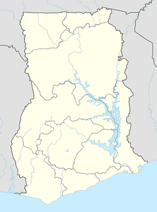
Tafo
Lodging
库马西,铜牌宾馆
Mampong Road, Kumasi
Lodging
read more
New Royal View Hotel
Kronum-Abuohia, Kumasi
Lodging
read more
Royal Crown Guest House
Pankrono, Kumasi
Lodging
read more
Platinum Hotel
Ahwiaa Overseas, Pankrono, Kumasi
Lodging
read more
Groovys Hotel Tafo
Kumasi
Lodging
read more
Frankont Village
Frankont Village Rd, Kumasi
Lodging
read more
Baudo Barigo Guest House
Adjacent Crown Prince International School, Kumasi
Lodging
read more
Longford Hotel
Opposite Akate Farms, off the Kenyasi Road, Kumasi
Lodging
read more
Top Hill Hotel
Kumasi
Lodging
read more
Arco Guest House
Pankronu, Kumasi
Lodging
read more
KRAKYE EXECUTIVE LODGE
Mampong Road, Kumasi
Lodging
read more
Abisarp Hotel
Kronom Abuohia, Kumasi
Lodging
read more
kronum kwapra
Unnamed Road, Kumasi
Lodging
read more
Kenyasi Behind Garden City University
kenyasi abrem rd
Lodging
read more
Nurom Hotel
Kumasi
Lodging
read more
Bakery
Cooks & Bakes-Cakes and Food Services
Cooks & Bakes, Kumasi
Bakery
read more
Bread Boutique- Tafo
Kumasi
Bakery
read more
Casso Foods and Cakes
UGC Station, Breman-Tafo Road, Breman, BOX SE 2299, Kumasi
Bakery
read more
Car dealer
Bigdreams Enterprise
Kumasi
Car dealer
read more
Royal Brobbey Ventures
PLT 29 BLK M Box SE 2301, Suame - Kumasi
Car dealer
read more
Place of worship
House Of Harvest Ministry
Bremen, Kumasi
Place of worship
read more
House Of Harvest Ministry
Breman, Kumasi
Place of worship
read more
St Anthony Roman Catholic Church Buokrom
Buokurom, Kumasi
Place of worship
read more
Breman UGC Central Kingdom Hall
6°44'35.5"N 1°37'39., 1
Place of worship
read more
Supermarket
New Supermarket
Kumasi
Supermarket
read more
Marfo Provision store
Kumasi
Supermarket
read more
Xpert Trading
Abrepo Road, Kumasi
Supermarket
read more
Kings Enterprise
Unnamed Road, Kumasi
Supermarket
read more
📑
Tafo all categories
Accounting
Administrative area level 1
Administrative area level 2
Atm
Bakery
Bank
Bar
Beauty salon
Bus station
Cafe
Car dealer
Car repair
Car wash
Cemetery
Church
City hall
Clothing store
Courthouse
Doctor
Electronics store
Finance
Fire station
Food
Furniture store
Gas station
General contractor
Grocery or supermarket
Hair care
Hardware store
Health
Home goods store
Hospital
Jewelry store
Laundry
Library
Liquor store
Local government office
Locality
Lodging
Mosque
Movie theater
Museum
Natural feature
Neighborhood
Park
Pharmacy
Place of worship
Point of interest
Police
Post office
Premise
Real estate agency
Restaurant
Roofing contractor
Route
School
Shoe store
Shopping mall
Storage
Store
Supermarket
Transit station
Travel agency
University
sublocality level 1
↑