Bakery nearby Christ Vision Enterprise
Ghana
Bakery nearby Christ Vision Enterprise
Christ Vision Enterprise
Koforidua Ghana
contacts phone
:
+233
Latitude:
6.1071865
, Longitude:
-0.2834022
read more
nearest Bakery
2.91 km
Pastry Shop
Ghana
Bakery
read more
2.935 km
B. Foster Bakery
Koforidua Central Business District, Koforidua
Bakery
read more
43.029 km
CakeHome Gh
ashiyie
Bakery
read more
44.917 km
Jag’s Bakery & Catering Services
Ashongman Estates
Bakery
read more
46.606 km
“DAILY BREAD” BAKERY
DAILY BREAD” HOUSE, A.C.P Roofing Tiles Junction off, Kwabenya-Pokuase Road, Kwabenya
Bakery
read more
46.622 km
Daily Bread House, A.C.P. Roofing Tiles Junction,
Kwabenya-Pokuase Road, Accra
Bakery
read more
46.692 km
Nyamekye Bakery
Adenta Municipality
Bakery
read more
47.08 km
Adenta Shopping Mall
Adenta Municipality
Bakery
read more
47.217 km
All Bakes Bakery
Ghana
Bakery
read more
47.744 km
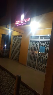
Cakes by Pona
Bakery
read more
49.059 km
Treacle Treats
House No. 223/3, Atomic Down, North Dome, Haatso-Atomic Road
Bakery
read more
49.241 km
Atta Maame’s Bakery
zongo junction, Madina
Bakery
read more
49.43 km
Hasanat Ventures
Accra Madina Social Welfare, Madina
Bakery
read more
49.65 km
Grace Cold Store
Tema
Bakery
read more
50.032 km
Sakie Bakery
Taifa
Bakery
read more
51.43 km
Bread Boutique
Ghana
Bakery
read more
51.931 km
Amakie's Bakery
Tema
Bakery
read more
52.056 km
B.A BAKERY
Tema
Bakery
read more
52.96 km
Bread Boutique
Ashaiman, Tema
Bakery
read more
53.433 km
Youngman Ike Bakery
Unnamed Road, Tema
Bakery
read more
53.895 km
Bread House Golf Estates
Tema
Bakery
read more
53.912 km
Great Success Bakery
Dawhenya
Bakery
read more
53.923 km
Bread Boutique Com.25
Tema
Bakery
read more
53.981 km
Little Bite Catering Services
Methodist Junction, Dawhenya
Bakery
read more
57.273 km
His Grace
Tema
Bakery
read more
📑
all categories
Accounting
Administrative area level 1
Administrative area level 2
Airport
Amusement park
Aquarium
Art gallery
Atm
Bakery
Bank
Bar
Beauty salon
Bicycle store
Book store
Bus station
Cafe
Campground
Car dealer
Car rental
Car repair
Car wash
Casino
Cemetery
Church
City hall
Clothing store
Colloquial area
Convenience store
Courthouse
Dentist
Department store
Doctor
Electrician
Electronics store
Embassy
Finance
Fire station
Florist
Food
Funeral home
Furniture store
Gas station
General contractor
Grocery or supermarket
Gym
Hair care
Hardware store
Health
Hindu Temple
Home goods store
Hospital
Insurance agency
Intersection
Jewelry store
Laundry
Lawyer
Library
Liquor store
Local government office
Locality
Locksmith
Lodging
Meal delivery
Meal takeaway
Mosque
Movie rental
Movie theater
Moving company
Museum
Natural feature
Neighborhood
Night club
Painter
Park
Parking
Pet store
Pharmacy
Physiotherapist
Place of worship
Plumber
Point of interest
Police
Post office
Premise
Real estate agency
Restaurant
Roofing contractor
Route
Rv park, camping
School
Shoe store
Shopping mall
Spa
Stadium
Storage
Store
Subpremise
Subway station
Supermarket
Synagogue
Taxi stand
Train station
Transit station
Travel agency
University
Veterinary care
Zoo
sublocality level 1
↑