Bakery nearby Creamy Bakes
Ghana
Bakery nearby Creamy Bakes
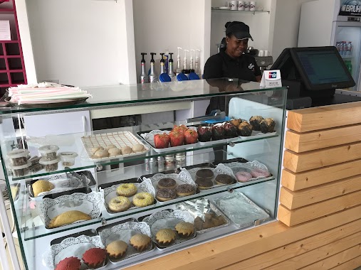
Creamy Bakes
Aggrey Street, Accra, Accra Metropolis, GH Ghana
contacts phone
:
+233 55 555 7022
website:
www.creamybakes.com
Latitude:
5.6371229
, Longitude:
-0.2136024
larger map & directions
read more
nearest Bakery
2.794 km
Bogiant Bakery
Ghana
Bakery
read more
2.957 km
Liawurdé J Bakers
Bakery
read more
3.044 km
Jesus Our Source Bakery
234 Saint Johns - Dome - Kwabenya - Brekusu Road, Taifa
Bakery
read more
3.271 km
CAKE AFFAIRS GH
GA-301-2274
Bakery
read more
3.288 km
House of Pasteries
Dzorwulu, Accra
Bakery
read more
3.411 km
Bread Boutique
Haatso-Atomic Road, Accra
Bakery
read more
3.57 km
Bofrot Gh
5.613909, -0.240204, Akweteyman
Bakery
read more
3.591 km
Tikva Treats
Santana Road, Accra
Bakery
read more
4.351 km
Foonoo Phood Factory
Accra
Bakery
read more
4.371 km
Cuppycake House
La-Bawaleshi Road, Accra
Bakery
read more
4.398 km
Treacle Treats
House No. 223/3, Atomic Down, North Dome, Haatso-Atomic Road
Bakery
read more
4.428 km
Sweetsi Cakes & Bakes
North Industrial Area, Accra
Bakery
read more
4.458 km
Jaesm Cakes
Accra
Bakery
read more
4.464 km
Evive Delights
Unnamed Rd
Bakery
read more
4.475 km
Loriey's Bakes
Unnamed Road, Lapaz
Bakery
read more
4.741 km
La Baguette
Ocansey Plaza
Bakery
read more
4.876 km
Sakie Bakery
Taifa
Bakery
read more
4.9 km
Jesus Our Source Bakery
Ghana
Bakery
read more
4.958 km
PartyFantastic
Abeka Road, Accra
Bakery
read more
5.128 km
Buttercup cakes
Accra
Bakery
read more
5.635 km
D café
Marina Mall, Airport Bypass Road, Accra
Bakery
read more
5.948 km
Baked Gh
Dr Tagoe St, Accra
Bakery
read more
6.415 km
Atta Maame’s Bakery
zongo junction, Madina
Bakery
read more
6.614 km
Just by Grace Catering and Floral Decor
Race Course Street, Accra
Bakery
read more
10.951 km
L'elysee Qac Biggies Bakery & Gift Shop
Ghana
Bakery
read more
📑
all categories
Accounting
Administrative area level 1
Administrative area level 2
Airport
Amusement park
Aquarium
Art gallery
Atm
Bakery
Bank
Bar
Beauty salon
Bicycle store
Book store
Bus station
Cafe
Campground
Car dealer
Car rental
Car repair
Car wash
Casino
Cemetery
Church
City hall
Clothing store
Colloquial area
Convenience store
Courthouse
Dentist
Department store
Doctor
Electrician
Electronics store
Embassy
Finance
Fire station
Florist
Food
Funeral home
Furniture store
Gas station
General contractor
Grocery or supermarket
Gym
Hair care
Hardware store
Health
Hindu Temple
Home goods store
Hospital
Insurance agency
Intersection
Jewelry store
Laundry
Lawyer
Library
Liquor store
Local government office
Locality
Locksmith
Lodging
Meal delivery
Meal takeaway
Mosque
Movie rental
Movie theater
Moving company
Museum
Natural feature
Neighborhood
Night club
Painter
Park
Parking
Pet store
Pharmacy
Physiotherapist
Place of worship
Plumber
Point of interest
Police
Post office
Premise
Real estate agency
Restaurant
Roofing contractor
Route
Rv park, camping
School
Shoe store
Shopping mall
Spa
Stadium
Storage
Store
Subpremise
Subway station
Supermarket
Synagogue
Taxi stand
Train station
Transit station
Travel agency
University
Veterinary care
Zoo
sublocality level 1
↑