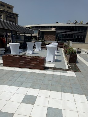
Cafe nearby Mint Coffee Club
Ghana
Cafe nearby Mint Coffee Club
Mint Coffee Club
Accra, Ghana
contacts phone
:
+233
Latitude:
5.6042066
, Longitude:
-0.1818953
larger map & directions
read more
nearest Cafe
36 m
Vida e Caffe
Astoria Palms, 5 ALema Avenue, Accra
Cafe
read more
564 m
Publix Grocery
Airport Residential Area, Accra
Cafe
read more
564 m
Publix Grocery
Airport Area, Accra
Cafe
read more
579 m
Mercedes Cafe - Silver Star Tower
Accra
Cafe
read more
591 m
ci gusta!
10 Patrice Lumumba Road, Accra
Cafe
read more
645 m
Café Kwae
Ground Floor, One Airport Square, Airport City, Accra
Cafe
read more
670 m
Vida e Caffè - One Airport Square
Airport City, Accra
Cafe
read more
681 m
Vida e Caffe
1 North Airport Road, Accra
Cafe
read more
686 m
Madam Rahi VIP Koko Joint
Airport Residential Area, Accra
Cafe
read more
689 m
d Café
Volta Street, Accra
Cafe
read more
696 m
Mug & Thyme
13 Agostinho Neto Road, Accra
Cafe
read more
700 m
5 Star Advertizing and Model Agency
Airport Road, Accra
Cafe
read more
739 m
vida e caffe - Airport Shell
Shell, Airport, Accra
Cafe
read more
1.152 km
Club 805
Third Close, Accra
Cafe
read more
1.192 km
Cuppa Cappuccino
6 Third Close, Accra
Cafe
read more
1.206 km
N8tive Food and Beverage Bar
57 Kofi Annan Street, Accra
Cafe
read more
1.377 km
Mugg and Bean
Airport Area, Accra
Cafe
read more
1.377 km
Mugg and Bean
Airport Residential Area, Accra
Cafe
read more
1.82 km
vida e caffe
Dzorwulu, Accra
Cafe
read more
1.881 km
Choco' Pain
Dzorwulu, Accra
Cafe
read more
2.2 km
Second Cup
Accra
Cafe
read more
2.447 km
Roasters Cafe
Odotei Tsui Street, Accra
Cafe
read more
2.539 km
The Breakfast Bar
Dzorwulu, Accra
Cafe
read more
3.899 km
LADL Patisserie
23 Latebu Crescent, East Cantonments Estates, Accra
Cafe
read more
3.946 km
The Chocolate shop
Adomi Street, Accra
Cafe
read more
📑
all categories
Accounting
Administrative area level 1
Administrative area level 2
Airport
Amusement park
Aquarium
Art gallery
Atm
Bakery
Bank
Bar
Beauty salon
Bicycle store
Book store
Bus station
Cafe
Campground
Car dealer
Car rental
Car repair
Car wash
Casino
Cemetery
Church
City hall
Clothing store
Colloquial area
Convenience store
Courthouse
Dentist
Department store
Doctor
Electrician
Electronics store
Embassy
Finance
Fire station
Florist
Food
Funeral home
Furniture store
Gas station
General contractor
Grocery or supermarket
Gym
Hair care
Hardware store
Health
Hindu Temple
Home goods store
Hospital
Insurance agency
Intersection
Jewelry store
Laundry
Lawyer
Library
Liquor store
Local government office
Locality
Locksmith
Lodging
Meal delivery
Meal takeaway
Mosque
Movie rental
Movie theater
Moving company
Museum
Natural feature
Neighborhood
Night club
Painter
Park
Parking
Pet store
Pharmacy
Physiotherapist
Place of worship
Plumber
Point of interest
Police
Post office
Premise
Real estate agency
Restaurant
Roofing contractor
Route
Rv park, camping
School
Shoe store
Shopping mall
Spa
Stadium
Storage
Store
Subpremise
Subway station
Supermarket
Synagogue
Taxi stand
Train station
Transit station
Travel agency
University
Veterinary care
Zoo
sublocality level 1
↑