Cemetery nearby Ashongman Cemetery
Ghana
Cemetery nearby Ashongman Cemetery
Ashongman Cemetery
Agbogba - Ashongman Road, Accra, Ga East, GH Ghana
contacts phone
:
+233
Latitude:
5.7043811
, Longitude:
-0.2116903
larger map & directions
read more
nearest Cemetery
1.611 km
Agbogba Cemetery
Agbogba
Cemetery
read more
3.747 km
Haatso-Ecomog Royal Cemetery
Haatso
Cemetery
read more
4.58 km
Adenta Cemetery
Ghana
Cemetery
read more
5.115 km
Stone Depot
Ghana
Cemetery
read more
6.104 km
Agyengo Stone Tiles
R40, Adenta Municipality
Cemetery
read more
6.803 km
Madina Public Cemetery
Madina
Cemetery
read more
7.201 km
Kisseman Christian Village Cemetery
Dome Road, Accra
Cemetery
read more
7.91 km
Pokuasi Cemetery
Ghana
Cemetery
read more
8.064 km
Ofankor Cemetary
Cemetery
read more
8.918 km
Muslim Cemetery
84 Lagos Avenue, Accra
Cemetery
read more
9.724 km
Gethsemane Memorial Garden
Accra
Cemetery
read more
10.895 km
Amrahia Cemetry
Amrahia
Cemetery
read more
11.103 km
Achimota Cemetery
Lapaz
Cemetery
read more
11.521 km
Achimota Cemetery
Akweyteman, Accra
Cemetery
read more
13.861 km
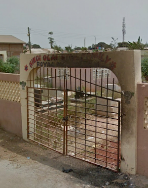
Nikoi Olai Stool Royal Mausoleum
bubuashie, Tafo Amon Street, Accra
Cemetery
read more
14.397 km
Bubiashie Cemetery
Accra
Cemetery
read more
14.646 km
Ankrah Royal Family Cemetery
Dantu Avenue, Accra
Cemetery
read more
15.37 km
Muslim Cemetery
Kpeshie
Cemetery
read more
16.006 km
La Cemetery
Accra
Cemetery
read more
16.277 km
NAGMAS LIMITED
Road Leading to Spintex-Sakumono, Tema
Cemetery
read more
18.473 km
Presby Cemetery
Accra
Cemetery
read more
18.473 km
Presby Cemetery
Acra
Cemetery
read more
18.899 km
Nungua Anglican Cemetary
Accra
Cemetery
read more
19.207 km
Zimmermann Presbyterian Cemetery
Unnamed Rd,, Accra
Cemetery
read more
19.823 km
Cemetery
Ghana
Cemetery
read more
📑
all categories
Accounting
Administrative area level 1
Administrative area level 2
Airport
Amusement park
Aquarium
Art gallery
Atm
Bakery
Bank
Bar
Beauty salon
Bicycle store
Book store
Bus station
Cafe
Campground
Car dealer
Car rental
Car repair
Car wash
Casino
Cemetery
Church
City hall
Clothing store
Colloquial area
Convenience store
Courthouse
Dentist
Department store
Doctor
Electrician
Electronics store
Embassy
Finance
Fire station
Florist
Food
Funeral home
Furniture store
Gas station
General contractor
Grocery or supermarket
Gym
Hair care
Hardware store
Health
Hindu Temple
Home goods store
Hospital
Insurance agency
Intersection
Jewelry store
Laundry
Lawyer
Library
Liquor store
Local government office
Locality
Locksmith
Lodging
Meal delivery
Meal takeaway
Mosque
Movie rental
Movie theater
Moving company
Museum
Natural feature
Neighborhood
Night club
Painter
Park
Parking
Pet store
Pharmacy
Physiotherapist
Place of worship
Plumber
Point of interest
Police
Post office
Premise
Real estate agency
Restaurant
Roofing contractor
Route
Rv park, camping
School
Shoe store
Shopping mall
Spa
Stadium
Storage
Store
Subpremise
Subway station
Supermarket
Synagogue
Taxi stand
Train station
Transit station
Travel agency
University
Veterinary care
Zoo
sublocality level 1
↑