Church nearby Church Of Pentecost Sarpeiman District
Coronavirus disease (COVID-19) Situation
confirmed cases
171889
deaths
1462
Ghana
Church nearby Church Of Pentecost Sarpeiman District
Church Of Pentecost Sarpeiman District
Ga West, Ghana
contacts phone
:
+233
Latitude:
5.7243393
, Longitude:
-0.3122246
larger map & directions
read more
nearest Church
240 m
Calvery Presby Church Sarpeiman
Ghana
Church
read more
352 m
Kingdom Hall of Jehovah’s Witnesses
Nw 35,, Nsawam
Church
read more
514 m
ICGC Prayer Temple
Ga, West
Church
read more
514 m
ICGC Prayer Temple
Sarpeiman, West
Church
read more
714 m
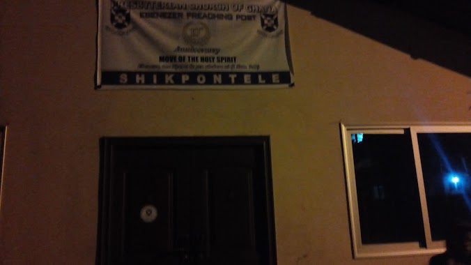
Presbyterian Church of Ghana - Shikpontele
Shikpontele
Church
read more
1.148 km
Macedonia Prayer Camp
Ghana
Church
read more
1.282 km
Shelter of God Ministry
Ga West, Amasaman
Church
read more
1.353 km
Power and Deeper Truth Church International
Ghana
Church
read more
1.399 km
Zion Divine Restoration Prayer Ministry
Ghana
Church
read more
1.458 km
Icgc Resurection Temple Community 21
Ghana
Church
read more
1.653 km
St. Bakhita Catholic Church
Ga, West
Church
read more
1.807 km
Jericho Tv Gh
Church
read more
1.81 km
The Church of Pentecost - Treba Assembly
Church
read more
1.825 km
Faithway Baptist Church
Ghana
Church
read more
1.858 km
Apostolic Church
Amasaman
Church
read more
1.899 km
Sacred Heart of Jesus Anglican Church
Amasaman
Church
read more
1.912 km
Assemblies Of God-Damax Branch
Church
read more
1.997 km
Mount Ararat Church international
Ghana
Church
read more
2.146 km
Amasaman SDA Church
Amasaman
Church
read more
2.15 km
Christ Apostolic Church International-Treba Assembly
Church
read more
2.23 km
The Church Of Pentecost-Mckeown Temple
Amasaman
Church
read more
2.303 km
Redeemed Church of God, Jesus Assembly
Amasaman
Church
read more
2.729 km
Christ's Rescue Ministry
House number WP 1090 Achiaman, Achiaman
Church
read more
2.961 km
Afiaman Presby Church
Church
read more
3.356 km
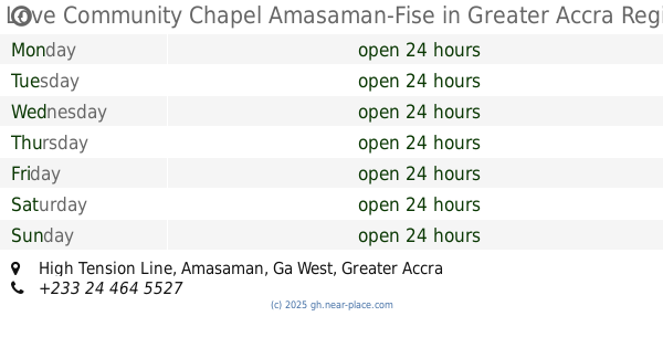
Love Community Chapel Amasaman-Fise
High Tension Line, Amasaman
Church
read more
📑
all categories
Accounting
Administrative area level 1
Administrative area level 2
Airport
Amusement park
Aquarium
Art gallery
Atm
Bakery
Bank
Bar
Beauty salon
Bicycle store
Book store
Bus station
Cafe
Campground
Car dealer
Car rental
Car repair
Car wash
Casino
Cemetery
Church
City hall
Clothing store
Colloquial area
Convenience store
Courthouse
Dentist
Department store
Doctor
Electrician
Electronics store
Embassy
Finance
Fire station
Florist
Food
Funeral home
Furniture store
Gas station
General contractor
Grocery or supermarket
Gym
Hair care
Hardware store
Health
Hindu Temple
Home goods store
Hospital
Insurance agency
Intersection
Jewelry store
Laundry
Lawyer
Library
Liquor store
Local government office
Locality
Locksmith
Lodging
Meal delivery
Meal takeaway
Mosque
Movie rental
Movie theater
Moving company
Museum
Natural feature
Neighborhood
Night club
Painter
Park
Parking
Pet store
Pharmacy
Physiotherapist
Place of worship
Plumber
Point of interest
Police
Post office
Premise
Real estate agency
Restaurant
Roofing contractor
Route
Rv park, camping
School
Shoe store
Shopping mall
Spa
Stadium
Storage
Store
Subpremise
Subway station
Supermarket
Synagogue
Taxi stand
Train station
Transit station
Travel agency
University
Veterinary care
Zoo
sublocality level 1
↑