Church nearby Deliverance Assemblies Of God Church
Ghana
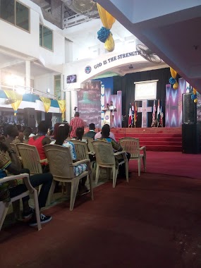
Church nearby Deliverance Assemblies Of God Church
Deliverance Assemblies Of God Church
Kotobabi, Accra Ghana
contacts phone
:
+233
Latitude:
5.60331
, Longitude:
-0.2058954
read more
nearest Church
189 m
True Jesus Church
Ebony Crescent, Accra
Church
read more
373 m
Christian Praise International Centre
Accra
Church
read more
385 m
Christco Church
Alajo, Accra
Church
read more
431 m
Triumph Centre A/G, Dzorwulu-Accra
Achimota Road, Accra
Church
read more
431 m
Praise World Ministries International
Accra
Church
read more
469 m
Perez Chapel International
105 Olusegun Obasanjo Way, Accra
Church
read more
493 m
The Word Deliverance Chapel
Dzorwulu,Accra
Church
read more
576 m
Global Evangelical Church, Kotobabi
6th Asafoatse Mankata Link, Accra
Church
read more
626 m
Universal Church Of Jesus
1st Nkurumah Lane, Accra
Church
read more
640 m
UCJ - Kotobabi
Kotobabi, Accra
Church
read more
665 m
ICGC Covenant Temple
1st Nkurumah Lane, Accra
Church
read more
682 m
Christ Apostolic Church International, Kotobabi Assembly
Unnamed Road, Accra
Church
read more
738 m
Mission of Hope
Nii Kwabena Bonne Crescent, Accra
Church
read more
850 m
Alajo Church of Christ
Alajo, Accra
Church
read more
939 m
word power pentecostal ministry
Alajo, Ayikailey maggie cl, Accra
Church
read more
939 m
SouthernGate Chapel Int.
Alajo, Accra
Church
read more
977 m
The Church of Pentecost
Accra
Church
read more
979 m
Baptist International Worship Centre
11 Yiyiwa Drive, Accra
Church
read more
979 m
Abelemkpe Pentecost Church
Abelemkpe, Accra
Church
read more
999 m
Christ Ambassadors Church
Alajo, Accra
Church
read more
1.004 km
Faith Independent Baptist Church
4th Close, Accra
Church
read more
1.027 km
St. Anthony's Anglican Church
Accra
Church
read more
1.068 km
Church Of Pentecost
Accra
Church
read more
1.114 km
Mt Zion Methodist Church, Sakumono.
Paradise Street, Accra
Church
read more
1.199 km
Bethel Methodist Society, Maamobi
Maamobi, Accra
Church
read more
📑
all categories
Accounting
Administrative area level 1
Administrative area level 2
Airport
Amusement park
Aquarium
Art gallery
Atm
Bakery
Bank
Bar
Beauty salon
Bicycle store
Book store
Bus station
Cafe
Campground
Car dealer
Car rental
Car repair
Car wash
Casino
Cemetery
Church
City hall
Clothing store
Colloquial area
Convenience store
Courthouse
Dentist
Department store
Doctor
Electrician
Electronics store
Embassy
Finance
Fire station
Florist
Food
Funeral home
Furniture store
Gas station
General contractor
Grocery or supermarket
Gym
Hair care
Hardware store
Health
Hindu Temple
Home goods store
Hospital
Insurance agency
Intersection
Jewelry store
Laundry
Lawyer
Library
Liquor store
Local government office
Locality
Locksmith
Lodging
Meal delivery
Meal takeaway
Mosque
Movie rental
Movie theater
Moving company
Museum
Natural feature
Neighborhood
Night club
Painter
Park
Parking
Pet store
Pharmacy
Physiotherapist
Place of worship
Plumber
Point of interest
Police
Post office
Premise
Real estate agency
Restaurant
Roofing contractor
Route
Rv park, camping
School
Shoe store
Shopping mall
Spa
Stadium
Storage
Store
Subpremise
Subway station
Supermarket
Synagogue
Taxi stand
Train station
Transit station
Travel agency
University
Veterinary care
Zoo
sublocality level 1
↑