Church nearby St. Thomas More Catholic church
Ghana
Church nearby St. Thomas More Catholic church
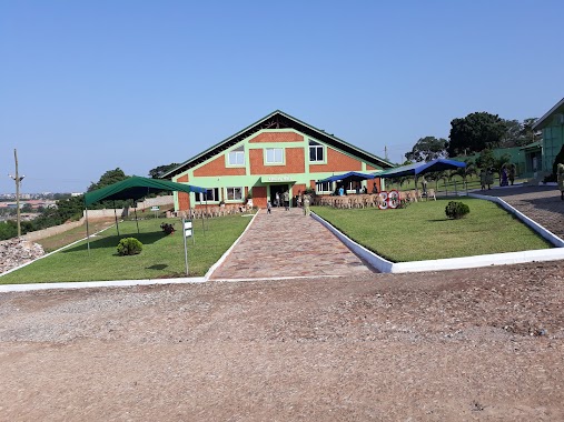
St. Thomas More Catholic church
Accra, Ghana
contacts phone
:
+233
website:
thomasmorejohnfisher.com
Latitude:
5.6245001
, Longitude:
-0.2197582
larger map & directions
read more
nearest Church
444 m
D Ambassadors Singing Ministry
Achimota, Signal Road, Accra
Church
read more
523 m
Presbyterian Church of Ghana Logos Congregation
Accra
Church
read more
635 m
SONRISE Meeting
Accra
Church
read more
653 m
Religious Society of Friends (Quakers) . Hillhouse Meeting
Achimota
Church
read more
657 m
ICGC Kratos Temple
Accra
Church
read more
815 m
Aggrey Chapel
Accra
Church
read more
834 m
Glory House Bible Church International
Accra
Church
read more
848 m
Greater Works Baptist Church, Achimota-Accra
Accra
Church
read more
874 m
Life International Church, Achimota, Accra, Greater Accra, Ghana
Accra
Church
read more
894 m
Chapel of Triumph
Accra
Church
read more
914 m
Empowerment Worship Centre
Behind the Stanbic Bank, Adjacent the New Lorry Station,, Achimota
Church
read more
926 m
Abofu Presby Church
Accra
Church
read more
939 m
Thiruvana Malai Dist Christiyan Charch
Christian Village, Accra
Church
read more
964 m
Greater Works Baptist Church
Accra
Church
read more
1.059 km
Eagles House Chapel Intl. (EHCI)
Christian Village, Accra
Church
read more
1.126 km
ICGC The Lords Tabernacle
Accra
Church
read more
1.223 km
The Church of Pentecost, Abofu W/C
Accra
Church
read more
1.483 km
Living Springs Int. Church
Accra
Church
read more
1.565 km
Evangel Church International
Unnamed Rd,, Accra
Church
read more
1.834 km
St. Anthony's Anglican Church
Accra
Church
read more
1.923 km
St. Louis Catholic church
Accra
Church
read more
2.101 km
Prevailing Christian Outreach Ministies
N1, Accra
Church
read more
2.223 km
COP,Tesano Worship Centre
West Loop Link 2, Accra
Church
read more
2.271 km
New Legon Presby Church, Oko
Parakuo Estates, Accra
Church
read more
2.342 km
Perez Chapel International
105 Olusegun Obasanjo Way, Accra
Church
read more
📑
all categories
Accounting
Administrative area level 1
Administrative area level 2
Airport
Amusement park
Aquarium
Art gallery
Atm
Bakery
Bank
Bar
Beauty salon
Bicycle store
Book store
Bus station
Cafe
Campground
Car dealer
Car rental
Car repair
Car wash
Casino
Cemetery
Church
City hall
Clothing store
Colloquial area
Convenience store
Courthouse
Dentist
Department store
Doctor
Electrician
Electronics store
Embassy
Finance
Fire station
Florist
Food
Funeral home
Furniture store
Gas station
General contractor
Grocery or supermarket
Gym
Hair care
Hardware store
Health
Hindu Temple
Home goods store
Hospital
Insurance agency
Intersection
Jewelry store
Laundry
Lawyer
Library
Liquor store
Local government office
Locality
Locksmith
Lodging
Meal delivery
Meal takeaway
Mosque
Movie rental
Movie theater
Moving company
Museum
Natural feature
Neighborhood
Night club
Painter
Park
Parking
Pet store
Pharmacy
Physiotherapist
Place of worship
Plumber
Point of interest
Police
Post office
Premise
Real estate agency
Restaurant
Roofing contractor
Route
Rv park, camping
School
Shoe store
Shopping mall
Spa
Stadium
Storage
Store
Subpremise
Subway station
Supermarket
Synagogue
Taxi stand
Train station
Transit station
Travel agency
University
Veterinary care
Zoo
sublocality level 1
↑