Church nearby Synagogue Church Of All Nations
Ghana
Church nearby Synagogue Church Of All Nations
Synagogue Church Of All Nations
1, Segun Irefin Street, Ikotun - Egbe Road,, lagos, Adenta Municipality, Ghana
contacts phone
:
+233 20 556 5773
Latitude:
5.7096052
, Longitude:
-0.1894873
larger map & directions
read more
nearest Church
622 m
Suncity Presbyterian Church, Suncity
Church
read more
674 m
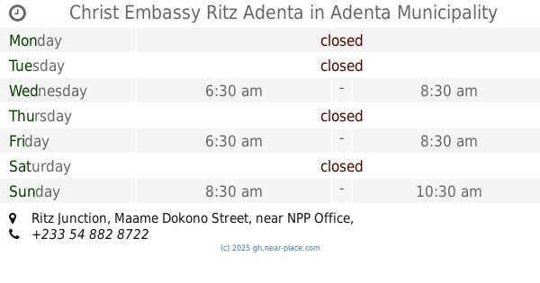
Christ Embassy Ritz Adenta
Ritz Junction, Maame Dokono Street, near NPP Office
Church
read more
738 m
Assemblies Of God West Adenta Sun City
Ghana
Church
read more
741 m
Inspiration Centre A/G
Assemblies of God, P&T/ West Adenta,, Accra
Church
read more
826 m
Faith Family International Ministries (FFIM)
Faith Family International Ministries (FFIM), Agbogba, SunCity, Madina
Church
read more
898 m
The Mega Church, Agbogba
Church
read more
1.019 km
Hope Preaching point
Ghana
Church
read more
1.074 km
Liberty House Chapel International
Church
read more
1.255 km
Anointed Family Chapel
Acra
Church
read more
1.255 km
Anointed Family Chapel
Akra
Church
read more
1.255 km
Anointed Family Chapel
Accra
Church
read more
1.269 km
Anointed Family Chapel
Ga East, Agbogba
Church
read more
1.331 km
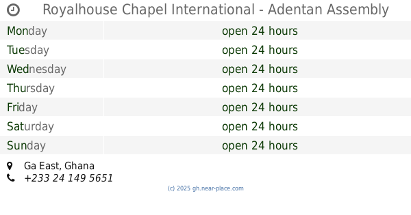
Royalhouse Chapel International - Adentan Assembly
Church
read more
1.708 km
king's dominion chapel int'l
Ghana
Church
read more
1.827 km
Church Of Christ, Agbogba
Sun City
Church
read more
1.838 km
Green Pastures Ministries
Shalom Estates, Adenta Municipality
Church
read more
1.996 km
HIS BANNER CHRISTIAN CENTRE
Pantang West
Church
read more
2.052 km
Resurrection Presbyterian Church, Ghana
Agbogba
Church
read more
2.053 km
Bethel Methodist Church
Church
read more
2.09 km
Ashongman Assembly, COP
Church
read more
2.144 km
Covenant Presby Church
Djorshie Street
Church
read more
2.149 km
Presbyterian Church Of Ghana - Convenant Congregation
Djorshie Street
Church
read more
2.197 km
EP church
Dampoo, Agbogba
Church
read more
2.361 km
Bethesda Methodist Church And School
Agbogba
Church
read more
2.631 km
Assemblies of God
Adenta West
Church
read more
📑
all categories
Accounting
Administrative area level 1
Administrative area level 2
Airport
Amusement park
Aquarium
Art gallery
Atm
Bakery
Bank
Bar
Beauty salon
Bicycle store
Book store
Bus station
Cafe
Campground
Car dealer
Car rental
Car repair
Car wash
Casino
Cemetery
Church
City hall
Clothing store
Colloquial area
Convenience store
Courthouse
Dentist
Department store
Doctor
Electrician
Electronics store
Embassy
Finance
Fire station
Florist
Food
Funeral home
Furniture store
Gas station
General contractor
Grocery or supermarket
Gym
Hair care
Hardware store
Health
Hindu Temple
Home goods store
Hospital
Insurance agency
Intersection
Jewelry store
Laundry
Lawyer
Library
Liquor store
Local government office
Locality
Locksmith
Lodging
Meal delivery
Meal takeaway
Mosque
Movie rental
Movie theater
Moving company
Museum
Natural feature
Neighborhood
Night club
Painter
Park
Parking
Pet store
Pharmacy
Physiotherapist
Place of worship
Plumber
Point of interest
Police
Post office
Premise
Real estate agency
Restaurant
Roofing contractor
Route
Rv park, camping
School
Shoe store
Shopping mall
Spa
Stadium
Storage
Store
Subpremise
Subway station
Supermarket
Synagogue
Taxi stand
Train station
Transit station
Travel agency
University
Veterinary care
Zoo
sublocality level 1
↑