Clothing store nearby Harmony Trends
Ghana
Clothing store nearby Harmony Trends
Harmony Trends
Accra Ghana
contacts phone
:
+233
Latitude:
5.6158516
, Longitude:
-0.0916879
read more
nearest Clothing store
273 m
Lynnchris Boutique
10th Avenue, Accra
Clothing store
read more
454 m
Divine Elegant Fashion
Batsonaa Highway, Accra
Clothing store
read more
523 m
Titi's Closet
Accra
Clothing store
read more
524 m
Takyiwa Textiles
Unnamed Road, Accra
Clothing store
read more
701 m
Love Fashion Centre
Buade Avenue, Accra
Clothing store
read more
837 m
Simbe Collection
Ghana
Clothing store
read more
978 m
Delight Clothing
Ghana
Clothing store
read more
1.143 km
NUET EVE'S CLOTHING
Nungua Central, Accra
Clothing store
read more
1.143 km
NUET EVE' CLOTHING
Nungua Central, Accra
Clothing store
read more
1.151 km
ROLLOYDS
Batsonaa Hwy, Accra, Accra
Clothing store
read more
1.197 km
Peeval Clothing
Batsonaa Highway, Accra
Clothing store
read more
1.398 km
Red Cotton
Baatsonaa, Accra
Clothing store
read more
1.405 km
Paddy's Boutique
Cactus Street, Accra
Clothing store
read more
1.516 km
Justy Fashion
Baatsonaa, Accra
Clothing store
read more
1.544 km
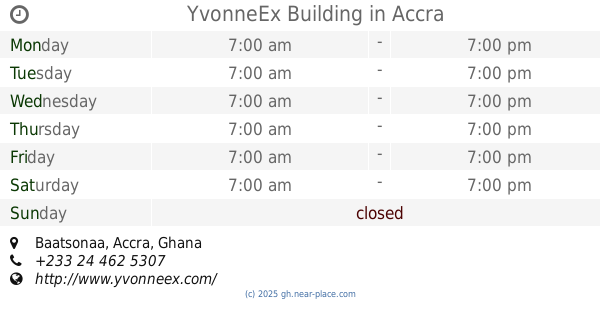
YvonneEx Building
Baatsonaa, Accra
Clothing store
read more
1.825 km
Hey Look Exclusive Wear
Ghana
Clothing store
read more
1.928 km
Geez Laundry
15ᵗʰ St, 15ᵗʰ Street
Clothing store
read more
1.984 km
The Shoe Box Store
Odai Ayiku Street Nungua Barrier
Clothing store
read more
2.098 km
Mr Young Fashion
22 Road Leading to Spintex-Sakumono
Clothing store
read more
2.132 km
Vexworld Apparel
16 Road Leading to Spintex-Sakumono
Clothing store
read more
2.148 km
Markbell Flora Decor And Mother Care
Nungua Market, Accra
Clothing store
read more
2.167 km
Sir Binks
Ghana
Clothing store
read more
2.416 km
Zoe African Wear Arena
off spintex road, Accra
Clothing store
read more
2.533 km
Children's Paradise Mothercare
10 Mango Street
Clothing store
read more
2.602 km
Zoe African Wear Arena
spintex Road Leading Community 19, Community 18
Clothing store
read more
📑
all categories
Accounting
Administrative area level 1
Administrative area level 2
Airport
Amusement park
Aquarium
Art gallery
Atm
Bakery
Bank
Bar
Beauty salon
Bicycle store
Book store
Bus station
Cafe
Campground
Car dealer
Car rental
Car repair
Car wash
Casino
Cemetery
Church
City hall
Clothing store
Colloquial area
Convenience store
Courthouse
Dentist
Department store
Doctor
Electrician
Electronics store
Embassy
Finance
Fire station
Florist
Food
Funeral home
Furniture store
Gas station
General contractor
Grocery or supermarket
Gym
Hair care
Hardware store
Health
Hindu Temple
Home goods store
Hospital
Insurance agency
Intersection
Jewelry store
Laundry
Lawyer
Library
Liquor store
Local government office
Locality
Locksmith
Lodging
Meal delivery
Meal takeaway
Mosque
Movie rental
Movie theater
Moving company
Museum
Natural feature
Neighborhood
Night club
Painter
Park
Parking
Pet store
Pharmacy
Physiotherapist
Place of worship
Plumber
Point of interest
Police
Post office
Premise
Real estate agency
Restaurant
Roofing contractor
Route
Rv park, camping
School
Shoe store
Shopping mall
Spa
Stadium
Storage
Store
Subpremise
Subway station
Supermarket
Synagogue
Taxi stand
Train station
Transit station
Travel agency
University
Veterinary care
Zoo
sublocality level 1
↑