Courthouse nearby Community Courts
Ghana
Courthouse nearby Community Courts
Community Courts
Accra, Ghana
contacts phone
:
+233
Latitude:
5.5436677
, Longitude:
-0.203412
larger map & directions
read more
nearest Courthouse
165 m
Motor Court
Accra
Courthouse
read more
185 m
Land Courts
High Street, Accra
Courthouse
read more
216 m
Commercial Courts
Thorpe Link, Accra
Courthouse
read more
267 m
Supreme Court of Ghana
Independence Avenue, Accra
Courthouse
read more
285 m
Court Stores
Thorpe Road, Accra
Courthouse
read more
295 m
Supreme Courts Administration
Accra
Courthouse
read more
790 m
The Law Courts Complex
John Evans Atta Mills High Street, Accra
Courthouse
read more
1.282 km
Adjabeng Court 1
Kwame Nkrumah Avenue, Accra
Courthouse
read more
1.435 km
James Town Court
James Fort Street, Accra
Courthouse
read more
1.765 km
Osu Court
Anumansa Street, Accra
Courthouse
read more
5.506 km
Aspect Court
Kpeshie
Courthouse
read more
5.527 km
La Court House
Accra
Courthouse
read more
7.182 km
Labadi Motor Court, Accra
Accra
Courthouse
read more
12.794 km
Kampala Courts
Accra
Courthouse
read more
14.246 km
Madina Magistrate Court
Madina
Courthouse
read more
16.67 km
Kwabenya Circuit Court
Kwabenya
Courthouse
read more
18.648 km
Municipal Court
Adenta Municipality
Courthouse
read more
18.682 km
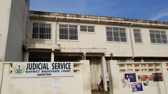
District Magistrate Court
Adenta Municipality
Courthouse
read more
20.233 km
Pokuase District Court
Ashaiman
Courthouse
read more
25.147 km
Tema High Court
Tema
Courthouse
read more
25.197 km
Ashaiman District Court
Ashaiman
Courthouse
read more
26.314 km
Ofaakor Circuit Court And District Court
Kasoa
Courthouse
read more
33.709 km
District Magistrate Court GD I Nsawam
Market/court Road, Nsawam
Courthouse
read more
📑
all categories
Accounting
Administrative area level 1
Administrative area level 2
Airport
Amusement park
Aquarium
Art gallery
Atm
Bakery
Bank
Bar
Beauty salon
Bicycle store
Book store
Bus station
Cafe
Campground
Car dealer
Car rental
Car repair
Car wash
Casino
Cemetery
Church
City hall
Clothing store
Colloquial area
Convenience store
Courthouse
Dentist
Department store
Doctor
Electrician
Electronics store
Embassy
Finance
Fire station
Florist
Food
Funeral home
Furniture store
Gas station
General contractor
Grocery or supermarket
Gym
Hair care
Hardware store
Health
Hindu Temple
Home goods store
Hospital
Insurance agency
Intersection
Jewelry store
Laundry
Lawyer
Library
Liquor store
Local government office
Locality
Locksmith
Lodging
Meal delivery
Meal takeaway
Mosque
Movie rental
Movie theater
Moving company
Museum
Natural feature
Neighborhood
Night club
Painter
Park
Parking
Pet store
Pharmacy
Physiotherapist
Place of worship
Plumber
Point of interest
Police
Post office
Premise
Real estate agency
Restaurant
Roofing contractor
Route
Rv park, camping
School
Shoe store
Shopping mall
Spa
Stadium
Storage
Store
Subpremise
Subway station
Supermarket
Synagogue
Taxi stand
Train station
Transit station
Travel agency
University
Veterinary care
Zoo
sublocality level 1
↑