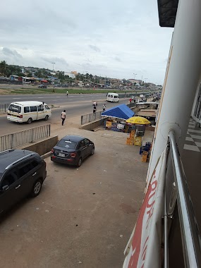
Gas station nearby Benab
Ghana
Gas station nearby Benab
Benab
Kwashieman, Ghana
contacts phone
:
+233
Latitude:
5.5973186
, Longitude:
-0.2709773
larger map & directions
read more
nearest Gas station
501 m
Goil Petrol Station
Kwashieman
Gas station
read more
503 m
Dukes Petroleum
Ofankor Road, Kwashieman
Gas station
read more
1.083 km
Manbah LPG Gas Filling Station
Unnamed Road,
Gas station
read more
1.547 km
GOIL Filling Station
Awoshie
Gas station
read more
1.559 km
Odorgonor Gas Station
Dogonor Road
Gas station
read more
1.591 km
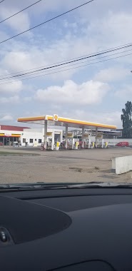
Shell Filling Station
Ghana
Gas station
read more
1.82 km
Sky petroleum
Accra
Gas station
read more
1.957 km
Fraga Oil Filling Station
Awoshie
Gas station
read more
2.024 km
Goil Service Station Tabora
Tabora Number Six (6) Bus Stop, Nii Okaiman West Main Road, Nii Okaiman West
Gas station
read more
2.034 km
Goil Filling Station
Nii Okaiman West
Gas station
read more
2.398 km
SAKAMAN TOTAL SERVICE STATION
5.573829, -0.278106, Sakaman
Gas station
read more
2.501 km
New Shell Filling Station
Accra
Gas station
read more
2.502 km
Dansoman Shell Filling Station
Winneba Road, Accra
Gas station
read more
2.628 km
Tabora Junction Bus Stop
Mount Taborr Street, Nii Okaiman West
Gas station
read more
2.777 km
GOIL Mallam Market
Accra
Gas station
read more
2.784 km
Goil Filling Station
Mallam Road, Accra
Gas station
read more
2.823 km
Shell
134 Nii Okaiman West Main Road, Nii Okaiman West
Gas station
read more
2.867 km
Allied Oil Filling Station
Abeka, Accra
Gas station
read more
2.906 km
Total Fuel Filling Station
Darkuman Road, Accra
Gas station
read more
2.99 km
Allied Petrol station
Sakaman, Accra
Gas station
read more
3.084 km
Shell Filling Station
Sowutoum main road
Gas station
read more
3.182 km
Total Fuel Station (Anyaa)
Ghana
Gas station
read more
3.316 km
Shell Filling Station
Gbawe Road, Mallam
Gas station
read more
3.435 km
Shell Filling Station - Mataheko
Kpakpo Mankralo Street, Accra
Gas station
read more
3.476 km
Star Oil Station
Gbawe Road, Mallam
Gas station
read more
📑
all categories
Accounting
Administrative area level 1
Administrative area level 2
Airport
Amusement park
Aquarium
Art gallery
Atm
Bakery
Bank
Bar
Beauty salon
Bicycle store
Book store
Bus station
Cafe
Campground
Car dealer
Car rental
Car repair
Car wash
Casino
Cemetery
Church
City hall
Clothing store
Colloquial area
Convenience store
Courthouse
Dentist
Department store
Doctor
Electrician
Electronics store
Embassy
Finance
Fire station
Florist
Food
Funeral home
Furniture store
Gas station
General contractor
Grocery or supermarket
Gym
Hair care
Hardware store
Health
Hindu Temple
Home goods store
Hospital
Insurance agency
Intersection
Jewelry store
Laundry
Lawyer
Library
Liquor store
Local government office
Locality
Locksmith
Lodging
Meal delivery
Meal takeaway
Mosque
Movie rental
Movie theater
Moving company
Museum
Natural feature
Neighborhood
Night club
Painter
Park
Parking
Pet store
Pharmacy
Physiotherapist
Place of worship
Plumber
Point of interest
Police
Post office
Premise
Real estate agency
Restaurant
Roofing contractor
Route
Rv park, camping
School
Shoe store
Shopping mall
Spa
Stadium
Storage
Store
Subpremise
Subway station
Supermarket
Synagogue
Taxi stand
Train station
Transit station
Travel agency
University
Veterinary care
Zoo
sublocality level 1
↑