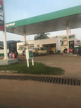
Gas station nearby Puma Filling Station
Ghana
Gas station nearby Puma Filling Station
Puma Filling Station
North Legon, Ghana
contacts phone
:
+233
Latitude:
5.6843875
, Longitude:
-0.1938439
larger map & directions
read more
nearest Gas station
196 m
Pacific Filling Station
Gas station
read more
215 m
Goil Service Station
Ghana
Gas station
read more
745 m
Triple A Gas
Gas station
read more
789 m
Petroland Filling Station
Agbogba - Ashongman Road, Accra
Gas station
read more
883 m
Ready Filling Station
Gas station
read more
883 m
Ready Filling Station
Agbogba
Gas station
read more
1.136 km
Ecowas road goil filling station
Ecowas Road, Madina
Gas station
read more
1.738 km
Shell Filling Station
Gas station
read more
1.807 km
Powerland Total Service Station
Redco
Gas station
read more
1.807 km
Total
Redco
Gas station
read more
1.911 km
Shell Filling Station KFC
Gas station
read more
1.979 km
Shell Filling Station (Haatso)
Haatso-Atomic Road, Accra
Gas station
read more
2.135 km
Unity Oil
Haatso
Gas station
read more
2.143 km
Maxxon Filling Station - Haatso Branch
Haatso
Gas station
read more
2.242 km
Total Filling Station - Haatso
6 Westlands Boulevard, Haatso
Gas station
read more
2.245 km
HAATSO ECOMOG JUNCTION TOTAL SERVICE STATION
5.667690, -0.205489, Haasto - Atomic Rd, Haasto
Gas station
read more
2.245 km
Total
5.667690, -0.205489, Haasto - Atomic Rd, Haasto
Gas station
read more
2.245 km
TOTAL Tankstelle
5.667690, -0.205489, Haasto - Atomic Rd, Haasto
Gas station
read more
2.422 km
Puma Filing Station - Haatso
39 / 41, Haatso-Atomic Road
Gas station
read more
2.548 km
Lone Star Gas Station
Ghana
Gas station
read more
2.572 km
Benab House Atomic Junction
Gas station
read more
2.578 km
Benab Filling Station
Haatso-Atomic Road
Gas station
read more
3.072 km
Goil Filling Station
Ghana
Gas station
read more
3.101 km
AI Petrol Station
Westlands Boulevard, Accra
Gas station
read more
3.131 km
Allied
Westland Boulevard Road, Accra
Gas station
read more
📑
all categories
Accounting
Administrative area level 1
Administrative area level 2
Airport
Amusement park
Aquarium
Art gallery
Atm
Bakery
Bank
Bar
Beauty salon
Bicycle store
Book store
Bus station
Cafe
Campground
Car dealer
Car rental
Car repair
Car wash
Casino
Cemetery
Church
City hall
Clothing store
Colloquial area
Convenience store
Courthouse
Dentist
Department store
Doctor
Electrician
Electronics store
Embassy
Finance
Fire station
Florist
Food
Funeral home
Furniture store
Gas station
General contractor
Grocery or supermarket
Gym
Hair care
Hardware store
Health
Hindu Temple
Home goods store
Hospital
Insurance agency
Intersection
Jewelry store
Laundry
Lawyer
Library
Liquor store
Local government office
Locality
Locksmith
Lodging
Meal delivery
Meal takeaway
Mosque
Movie rental
Movie theater
Moving company
Museum
Natural feature
Neighborhood
Night club
Painter
Park
Parking
Pet store
Pharmacy
Physiotherapist
Place of worship
Plumber
Point of interest
Police
Post office
Premise
Real estate agency
Restaurant
Roofing contractor
Route
Rv park, camping
School
Shoe store
Shopping mall
Spa
Stadium
Storage
Store
Subpremise
Subway station
Supermarket
Synagogue
Taxi stand
Train station
Transit station
Travel agency
University
Veterinary care
Zoo
sublocality level 1
↑