Gym nearby Befit Ghana
Ghana
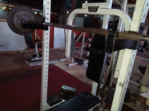
Gym nearby Befit Ghana
Befit Ghana
Greater Accra Region Ghana
contacts phone
:
+233
Latitude:
5.6866251
, Longitude:
-0.1404016
read more
nearest Gym
114 m
X-GYM FITNESS CENTRE
Madina
Gym
read more
676 m
Awudey Ville
Aben woha
Gym
read more
777 m
Bibs Place
Ghana
Gym
read more
1.047 km
Healthy Touch Physiotherapy Centre
Ashalley-Botwe, Madina
Gym
read more
1.659 km
Dane Studio
Ogbodjo
Gym
read more
1.836 km
Selemef Fitness Centre
Ghana
Gym
read more
2.476 km
Daily Fitness
The Hub, Prestige Estates, NTHC, Adjiringano, BOX CT9804 CANTONMENTS ACCRA, Accra
Gym
read more
2.515 km
Ultimate Ghana Fitness Studio
Accra
Gym
read more
2.57 km
Daily Fitness Gym & Aerobics Center
Ghana
Gym
read more
2.782 km
Ebenezer Gym
Adenta Municipality
Gym
read more
2.831 km
Befit Ghana Gym & Fitness Center
Tema
Gym
read more
2.868 km
Befit Ghana Gym
Greater
Gym
read more
3.515 km
Victory Presbyterian Church Field
Adenta Municipality
Gym
read more
3.935 km
Dreamz Fitness
PH Hotels, East Legon, Boundary Road, Accra
Gym
read more
4.004 km
The King's Assembly Int. Min.
Madina
Gym
read more
4.036 km
Lakeside Estates, Community 8 tennis court
Tema
Gym
read more
4.413 km
Davies Palace - Salon, Spa, Barbering & Gym
East Legon, Accra
Gym
read more
4.535 km
Gym Ike Fitness & Health Club Center
Adenta Municipality
Gym
read more
4.984 km
Pulse Fitness, Lizzy Sports Complex
16, 4 Cotton Street, Accra
Gym
read more
5.023 km
Franchesca's Curves
Boundary Road, Accra
Gym
read more
5.073 km
North Legon Spa
Kofi Annan Ave, Opposite North Legon Hospital
Gym
read more
5.126 km
Total Fitness Health Club
Accra
Gym
read more
5.639 km
Bodybasics Health & Beauty Center
Legon East Road, Accra
Gym
read more
6.3 km
TheMuscleMutationCentre
Spintex Road, Accra
Gym
read more
6.367 km
Africa Eleven Football Park
Spintex Road, Accra
Gym
read more
📑
all categories
Accounting
Administrative area level 1
Administrative area level 2
Airport
Amusement park
Aquarium
Art gallery
Atm
Bakery
Bank
Bar
Beauty salon
Bicycle store
Book store
Bus station
Cafe
Campground
Car dealer
Car rental
Car repair
Car wash
Casino
Cemetery
Church
City hall
Clothing store
Colloquial area
Convenience store
Courthouse
Dentist
Department store
Doctor
Electrician
Electronics store
Embassy
Finance
Fire station
Florist
Food
Funeral home
Furniture store
Gas station
General contractor
Grocery or supermarket
Gym
Hair care
Hardware store
Health
Hindu Temple
Home goods store
Hospital
Insurance agency
Intersection
Jewelry store
Laundry
Lawyer
Library
Liquor store
Local government office
Locality
Locksmith
Lodging
Meal delivery
Meal takeaway
Mosque
Movie rental
Movie theater
Moving company
Museum
Natural feature
Neighborhood
Night club
Painter
Park
Parking
Pet store
Pharmacy
Physiotherapist
Place of worship
Plumber
Point of interest
Police
Post office
Premise
Real estate agency
Restaurant
Roofing contractor
Route
Rv park, camping
School
Shoe store
Shopping mall
Spa
Stadium
Storage
Store
Subpremise
Subway station
Supermarket
Synagogue
Taxi stand
Train station
Transit station
Travel agency
University
Veterinary care
Zoo
sublocality level 1
↑