Health nearby Precilab Diagnostic
Ghana
Health nearby Precilab Diagnostic
Precilab Diagnostic
Accra, Ghana
contacts phone
:
+233 57 457 6739
Latitude:
5.5927164
, Longitude:
-0.1996442
larger map & directions
read more
nearest Health
511 m
Ultima Medical Laboratories
Sonku Loop, Accra
Health
read more
542 m
St. Martins Clinic
Oku Street, Accra
Health
read more
760 m
Tobinco pharmaceuticals Ltd
Kotobabi Down,Domiabra Street, Kotobabi Road
Health
read more
1.148 km
New Cross Clinic
Nima, Accra
Health
read more
1.185 km
Lesson Pharmacy
Al-Waleed bin Talal Highway, Accra
Health
read more
1.311 km
Mediwise International Company Limited
Accra
Health
read more
1.364 km
Bennett Memorial Clinic & Maternity Home
1 Obutu Road, Accra
Health
read more
1.4 km
Retro Eyeglasses By Tasha
Yooyi Lane, Accra
Health
read more
1.449 km
Adepa Pharmaceuticals Ltd.
7 Patrice Lumumba Road, Accra
Health
read more
1.53 km
Leila Memorial Centre
Nima, Accra
Health
read more
1.586 km
Dream Predators
No. 19, Obutu Road, Accra
Health
read more
1.779 km
Life Check Chemist
Accra
Health
read more
1.861 km
BK STRATEGIC GROUP
12 bridge St, Ashongman Estate
Health
read more
1.893 km
Lemla Veterinary Services
10 Agostinho Neto Road, Accra
Health
read more
1.935 km
Worldview Pharmacy
Roman Ridge Shopping Arcade
Health
read more
1.936 km
Citadel clinic
Accra
Health
read more
2.129 km
St Andrews Clinic
Nortei Ababio Street, Accra
Health
read more
2.173 km
FEST INTERNATIONAL CLINIC (DR Victor KANDA)
Abelemkpe, Accra
Health
read more
2.223 km
Medrite Pharmacy Ltd .
Kokomlemle, Accra
Health
read more
2.229 km
Overa Ltd
La Accra, Near Newmont Africa Head Office, Airport Residential Area, Noi Fetreke Street, Accra
Health
read more
2.372 km
Avis Chemist
13 Abelenkpe Road, Accra
Health
read more
2.374 km
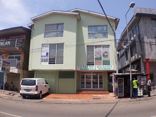
LYMENS CHEMIST WHOLESALE DIVISION
38 Faanofa Road, Accra
Health
read more
2.389 km
BF SUMA GHANA HEAD OFFICE
51 Faanofa Road, Accra
Health
read more
2.404 km
Healthmark Pharmacy
54 Faanofa Road, Accra
Health
read more
2.63 km
A. Q. Community Pharmacy
Accra
Health
read more
📑
all categories
Accounting
Administrative area level 1
Administrative area level 2
Airport
Amusement park
Aquarium
Art gallery
Atm
Bakery
Bank
Bar
Beauty salon
Bicycle store
Book store
Bus station
Cafe
Campground
Car dealer
Car rental
Car repair
Car wash
Casino
Cemetery
Church
City hall
Clothing store
Colloquial area
Convenience store
Courthouse
Dentist
Department store
Doctor
Electrician
Electronics store
Embassy
Finance
Fire station
Florist
Food
Funeral home
Furniture store
Gas station
General contractor
Grocery or supermarket
Gym
Hair care
Hardware store
Health
Hindu Temple
Home goods store
Hospital
Insurance agency
Intersection
Jewelry store
Laundry
Lawyer
Library
Liquor store
Local government office
Locality
Locksmith
Lodging
Meal delivery
Meal takeaway
Mosque
Movie rental
Movie theater
Moving company
Museum
Natural feature
Neighborhood
Night club
Painter
Park
Parking
Pet store
Pharmacy
Physiotherapist
Place of worship
Plumber
Point of interest
Police
Post office
Premise
Real estate agency
Restaurant
Roofing contractor
Route
Rv park, camping
School
Shoe store
Shopping mall
Spa
Stadium
Storage
Store
Subpremise
Subway station
Supermarket
Synagogue
Taxi stand
Train station
Transit station
Travel agency
University
Veterinary care
Zoo
sublocality level 1
↑