places in Kintampo
Ghana
Kintampo
Kintampo
Administrative Region:
Brong-Ahafo Region
population:
49 046
calling code:
+233-35
postcode:
BKXXX
Location on the map of Ghana
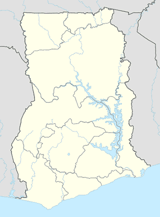
Kintampo
Church
Fountain Gate Chaple Kyeremankoma
Kintampo
Church
read more
Evangelical Christ Foundation Church
Kintampo
Church
read more
Kingdom Hall of Jehovahs Witnesses
Kintampo
Church
read more
St. Joseph Parish
Kintampo
Church
read more
Clothing store
KINGSMEN CLOTHING
Ntankoro station, Kintampo
Clothing store
read more
Gas station
LIA Gas Station
Gas station
read more
KINTAMPO TOTAL SERVICE STATION
8.052905, -1.726675, Kintampo
Gas station
read more
Nante Zongo
Kintampo Health Research Centre, KP, Techiman-Tamale Road, Kintampo
Gas station
read more
Puma Station
Techiman-Tamale Road, Kintampo
Gas station
read more
Health
Kintampo Health Research Centre
Hospital Road,, Near Kintampo-north Municipal Hospital, Kintampo
Health
read more
Mosque
Kintampo Central Mosque
Kintampo
Mosque
read more
At Taqwa Masjid
Kintampo
Mosque
read more
📑
Kintampo all categories
Administrative area level 1
Administrative area level 2
Bank
Church
Clothing store
Electronics store
Finance
Gas station
Grocery or supermarket
Health
Home goods store
Hospital
Local government office
Locality
Lodging
Mosque
Park
Pharmacy
Place of worship
Point of interest
Post office
Premise
Restaurant
Route
School
Shopping mall
Store
Travel agency
University
↑