places in Obuasi
Ghana
Obuasi
Obuasi
Administrative Region:
Ashanti Region
population:
180 460
calling code:
+233-32
postcode:
AOXXX
Location on the map of Ghana
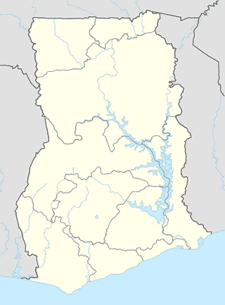
Obuasi
Book store
Akwaaba Bookshop & Stationary
Obuasi High Street, Obuasi
Book store
read more
Unique Book Shop
Obuasi Asokwa Road, Obuasi
Book store
read more
Bistie Bookshop And Provisions
Obuasi Asokwa Road, Obuasi
Book store
read more
Bus station
Bill Haussey Bus Stop
Anyinam Road, Anyinam
Bus station
read more
BEDIEM TAXI RANK
Bidaem
Bus station
read more
Obuasi Main Bus Station
Obuasi
Bus station
read more
Sam Jonah Bus Stop E - Line
Anyinam Road, Anyinam
Bus station
read more
Sam Jonah Bus Stop, F - Line
Anyinam Road, Anyinam
Bus station
read more
Bedieso Bus Stop
Obuasi High Street, Obuasi
Bus station
read more
Mangoase Bus Stop
Obuasi High Street, Obuasi
Bus station
read more
Cafe
Majora Travels & Educational Consult
Horsey Park store, #214, Obuasi
Cafe
read more
Car repair
Cummins Ghana
Obuasi
Car repair
read more
Church
Living Faith Assemblies of God Church.
Obuasi
Church
read more
Eternal Life Ministry International
Obuasi
Church
read more
Wesleyan
Obuasi High Street, Obuasi
Church
read more
SDA Church
Obuasi
Church
read more
Overcomers Family Chapel Assemblies Of God Church
Obuasi
Church
read more
Victorious Chapel International
Obuasi
Church
read more
VCC
Obuasi
Church
read more
ROGIM RETREAT CENTRE
Obuasi
Church
read more
Church of Christ, Boete
Obuasi
Church
read more
Pentecost Church
Obuasi
Church
read more
Shalom Baptist Temple
Kwabrafoso, Opposite The Super Mambo Hotel, Along The Kwabrafo River, Obuasi
Church
read more
First Baptist
Estate
Church
read more
Ebenezer Methodist Church
Obuasi
Church
read more
God's fire revival ministry international
165 Obuasi High Street, Obuasi
Church
read more
Anyinam church of pentecost
Anyinam
Church
read more
📑
Obuasi all categories
Administrative area level 2
Bank
Bar
Beauty salon
Book store
Bus station
Cafe
Car repair
Church
City hall
Clothing store
Courthouse
Dentist
Electronics store
Finance
Florist
Food
Furniture store
Gas station
Grocery or supermarket
Gym
Hair care
Hardware store
Health
Home goods store
Hospital
Insurance agency
Jewelry store
Library
Local government office
Locality
Lodging
Mosque
Natural feature
Neighborhood
Night club
Park
Pharmacy
Place of worship
Point of interest
Police
Post office
Premise
Real estate agency
Restaurant
Route
School
Shoe store
Shopping mall
Stadium
Store
Supermarket
Train station
Veterinary care
sublocality level 1
↑