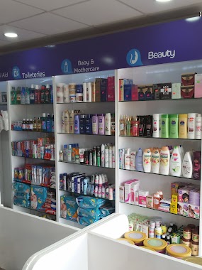
Pharmacy nearby Cristalife Pharmacy
Ghana
Pharmacy nearby Cristalife Pharmacy
Cristalife Pharmacy
Opposite K. Ofori Enterprises, Accra, Accra Metropolis, GH Ghana
contacts phone
:
+233
Latitude:
5.6335685
, Longitude:
-0.0980991
larger map & directions
read more
nearest Pharmacy
354 m
Cbv Pharmacy
Ghana
Pharmacy
read more
354 m
Cbv Pharmacy
Pharmacy
read more
394 m
Provivo Pharmaceuticals Ltd.
Spintex Road, Estate
Pharmacy
read more
645 m
Pills n Tabs Pharmacy - Spintex Branch
5°38'10.6"N 0°06'11., 4th Avenue, Accra
Pharmacy
read more
1.147 km
Cedar Life Pharmacy
19 th boundary road okpoi gomno
Pharmacy
read more
1.16 km
Odaremma Pharmacy
Ghana
Pharmacy
read more
1.46 km
Vicar Pharmacy
14, Batsonaa Highway, Accra
Pharmacy
read more
1.498 km
Life Door Pharmacy Ltd.
Okpoi Gonno, Accra
Pharmacy
read more
1.615 km
Retina Pharmacy & Cosmetics
Spintex Road, Accra
Pharmacy
read more
1.66 km
Blue Plaza By Baatsona total
29, Mango Street
Pharmacy
read more
1.666 km
Blue Plaza
64 Mango Street, community 16 road, Baatsona
Pharmacy
read more
1.784 km
Delivery Chemist Limited
Baatsona
Pharmacy
read more
1.898 km
Blue Plaza Baatsona
29 Mango St, 29 Mango Street
Pharmacy
read more
2.362 km
Peekee Pharmacy Ltd.
Ghana
Pharmacy
read more
2.365 km
Aide Chemists Bastona
8 Mango Street
Pharmacy
read more
2.408 km
Aide Chemists
2 Mango Street
Pharmacy
read more
2.595 km
Entrance Pharmaceutical - Tobinco Group
21 Spintex Road, Accra
Pharmacy
read more
2.607 km
Crest Pharmacy
Tema
Pharmacy
read more
2.624 km
Optimum Care Pharmacy
Unnamed Road, Madina Aknac Hotel, Trasacco, Accra
Pharmacy
read more
2.842 km
Lardicare Ltd
Ghana
Pharmacy
read more
2.853 km
Supreme Trust Pharmaceutical (Wholesale)
103 Road Leading Community 19, Tema New Town
Pharmacy
read more
3.254 km
Ernest Chemist Limited
Accra
Pharmacy
read more
3.288 km
Ophyl Pharmacy Ltd.
Ghana
Pharmacy
read more
3.396 km
Pharmacy
Nungua Main Road, Tema
Pharmacy
read more
3.668 km
Fabby Chemists
J269/4, Nungua-Tema Main Road, Nungua
Pharmacy
read more
📑
all categories
Accounting
Administrative area level 1
Administrative area level 2
Airport
Amusement park
Aquarium
Art gallery
Atm
Bakery
Bank
Bar
Beauty salon
Bicycle store
Book store
Bus station
Cafe
Campground
Car dealer
Car rental
Car repair
Car wash
Casino
Cemetery
Church
City hall
Clothing store
Colloquial area
Convenience store
Courthouse
Dentist
Department store
Doctor
Electrician
Electronics store
Embassy
Finance
Fire station
Florist
Food
Funeral home
Furniture store
Gas station
General contractor
Grocery or supermarket
Gym
Hair care
Hardware store
Health
Hindu Temple
Home goods store
Hospital
Insurance agency
Intersection
Jewelry store
Laundry
Lawyer
Library
Liquor store
Local government office
Locality
Locksmith
Lodging
Meal delivery
Meal takeaway
Mosque
Movie rental
Movie theater
Moving company
Museum
Natural feature
Neighborhood
Night club
Painter
Park
Parking
Pet store
Pharmacy
Physiotherapist
Place of worship
Plumber
Point of interest
Police
Post office
Premise
Real estate agency
Restaurant
Roofing contractor
Route
Rv park, camping
School
Shoe store
Shopping mall
Spa
Stadium
Storage
Store
Subpremise
Subway station
Supermarket
Synagogue
Taxi stand
Train station
Transit station
Travel agency
University
Veterinary care
Zoo
sublocality level 1
↑