Pharmacy nearby Tab Pharmacy
Ghana
Pharmacy nearby Tab Pharmacy
Tab Pharmacy
North Legon, Ghana
contacts phone
:
+233
Latitude:
5.6902121
, Longitude:
-0.196876
larger map & directions
read more
nearest Pharmacy
1.266 km
CLINISERVE PHARMACY
Ecowas Road, Madina
Pharmacy
read more
1.54 km
Haatso Pharmacy
Haatso
Pharmacy
read more
1.703 km
Pharmacy
Agbogba - Ashongman Road
Pharmacy
read more
1.793 km
GBEas
Haatso
Pharmacy
read more
1.891 km
Efkwa Pharmacy
Agbogba - Ashongman Road, Accra
Pharmacy
read more
2.538 km
CS Allot Pharmacy
Haatso-Atomic Road, Haatso
Pharmacy
read more
2.588 km
Radiance Pharmacy
Ghana
Pharmacy
read more
2.752 km
Telad Pharmacy
Ghana
Pharmacy
read more
2.762 km
Atomic Road Pharmacy
Haatso
Pharmacy
read more
2.846 km
Vynne Pharmacy
Ghana
Pharmacy
read more
2.863 km
Adniad Pharmacy
Adenta Municipality
Pharmacy
read more
2.864 km
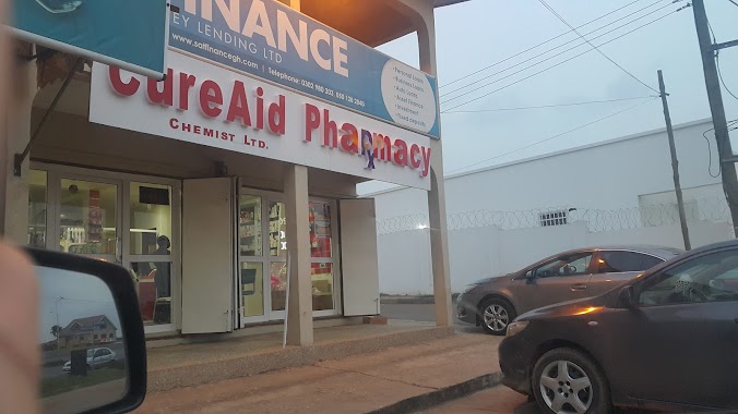
CureAid Pharmacy
Adenta, Adenta,Accra
Pharmacy
read more
2.948 km
PillPoint Pharmacy - Adenta (Wholesale)
Ghana
Pharmacy
read more
2.957 km
Samah Chemist
N4, Madina
Pharmacy
read more
2.964 km
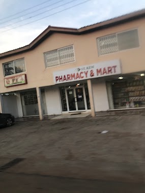
St Kem Pharmacy and Mart
Pharmacy
read more
2.989 km
Betvin Pharmacy
Legon East Road, Madina
Pharmacy
read more
3.055 km
Mal-Titi Chemists Ltd. Day & Night Dispensing Chemist
Ghana
Pharmacy
read more
3.184 km
Radiance Pharmacy
Accra
Pharmacy
read more
3.233 km
Olives Chemists Pharmacy
Ghana
Pharmacy
read more
3.41 km
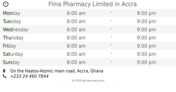
Fiina Pharmacy Limited
On the Haatso-Atomic main road
Pharmacy
read more
4.481 km
24/7 Mother-Love Pharmacy
Adenta Municipality
Pharmacy
read more
5.279 km
Discount Pharmacy
Trinity Avenue, Accra
Pharmacy
read more
5.485 km
Crystal Tabs Pharmacy
49 Saint Johns - Dome - Kwabenya - Brekusu Road, Taifa
Pharmacy
read more
5.871 km
Atmes Chemicals & Herbal Centre
Saint Johns - Dome - Kwabenya - Brekusu Road, Taifa
Pharmacy
read more
6.239 km
Pharmacy
243 Saint Johns - Dome - Kwabenya - Brekusu Road, Taifa
Pharmacy
read more
📑
all categories
Accounting
Administrative area level 1
Administrative area level 2
Airport
Amusement park
Aquarium
Art gallery
Atm
Bakery
Bank
Bar
Beauty salon
Bicycle store
Book store
Bus station
Cafe
Campground
Car dealer
Car rental
Car repair
Car wash
Casino
Cemetery
Church
City hall
Clothing store
Colloquial area
Convenience store
Courthouse
Dentist
Department store
Doctor
Electrician
Electronics store
Embassy
Finance
Fire station
Florist
Food
Funeral home
Furniture store
Gas station
General contractor
Grocery or supermarket
Gym
Hair care
Hardware store
Health
Hindu Temple
Home goods store
Hospital
Insurance agency
Intersection
Jewelry store
Laundry
Lawyer
Library
Liquor store
Local government office
Locality
Locksmith
Lodging
Meal delivery
Meal takeaway
Mosque
Movie rental
Movie theater
Moving company
Museum
Natural feature
Neighborhood
Night club
Painter
Park
Parking
Pet store
Pharmacy
Physiotherapist
Place of worship
Plumber
Point of interest
Police
Post office
Premise
Real estate agency
Restaurant
Roofing contractor
Route
Rv park, camping
School
Shoe store
Shopping mall
Spa
Stadium
Storage
Store
Subpremise
Subway station
Supermarket
Synagogue
Taxi stand
Train station
Transit station
Travel agency
University
Veterinary care
Zoo
sublocality level 1
↑