School nearby Kporbikorpe School
Ghana
School nearby Kporbikorpe School
Kporbikorpe School
Ghana Ghana
contacts phone
:
+233
Latitude:
5.7339477
, Longitude:
-0.2905557
read more
nearest School
1.475 km
Newlife Advent School
Ghana
School
read more
1.561 km
Firm Foundation Academy
Ghana
School
read more
1.563 km
Firm Foundation International School
Ghana
School
read more
1.914 km
Millenium J. H. S
Mayera, Pokuase
School
read more
2 km
Fairm Foundation Academy
Ghana
School
read more
2.199 km
Crystal Heights Intentional School
School
read more
2.222 km
Watford Montesori
Ghana
School
read more
2.458 km
Seat of Wisdom Perp.Sch
Nsawam
School
read more
2.614 km
Samsam Odumase
School
read more
2.623 km
Sarpeiman JHS DC
N6
School
read more
2.738 km
Kuntunse M/A Cluster Of Schools
School
read more
2.917 km
SAMJET MEDIA INSTITUTE
Amasaman
School
read more
2.98 km
Trinity Presbyterian Church, Kutunse
School
read more
3.006 km
Lovann School Complex
Amasaman
School
read more
3.134 km
Jhs school
Amasaman st charles
School
read more
3.876 km
Triumph School4Kids - Medie Branch
Medie
School
read more
3.879 km
Triumph School4Kids (TS4K) - Medie Branch
Ga West Municipal Assembly Medie Samsam Junction, Medie
School
read more
3.901 km
EPA Training School
Hospital Road, Amasaman, Amasaman
School
read more
3.949 km
Mother Maria Teres Int'l School
Medie
School
read more
4.512 km
Little Einstein Montessori
ACP Estate
School
read more
4.591 km
Roka International School
Nii Kpakpo Oblipong Street
School
read more
4.667 km
KNUST Kwabenya Campus
Unnamed Rd
School
read more
4.921 km
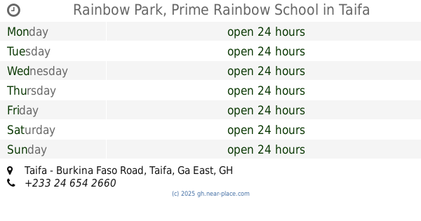
Rainbow Park, Prime Rainbow School
Taifa - Burkina Faso Road, Taifa
School
read more
4.979 km
Holy Light Academy
School
read more
5.832 km
Republic Model School
School
read more
📑
all categories
Accounting
Administrative area level 1
Administrative area level 2
Airport
Amusement park
Aquarium
Art gallery
Atm
Bakery
Bank
Bar
Beauty salon
Bicycle store
Book store
Bus station
Cafe
Campground
Car dealer
Car rental
Car repair
Car wash
Casino
Cemetery
Church
City hall
Clothing store
Colloquial area
Convenience store
Courthouse
Dentist
Department store
Doctor
Electrician
Electronics store
Embassy
Finance
Fire station
Florist
Food
Funeral home
Furniture store
Gas station
General contractor
Grocery or supermarket
Gym
Hair care
Hardware store
Health
Hindu Temple
Home goods store
Hospital
Insurance agency
Intersection
Jewelry store
Laundry
Lawyer
Library
Liquor store
Local government office
Locality
Locksmith
Lodging
Meal delivery
Meal takeaway
Mosque
Movie rental
Movie theater
Moving company
Museum
Natural feature
Neighborhood
Night club
Painter
Park
Parking
Pet store
Pharmacy
Physiotherapist
Place of worship
Plumber
Point of interest
Police
Post office
Premise
Real estate agency
Restaurant
Roofing contractor
Route
Rv park, camping
School
Shoe store
Shopping mall
Spa
Stadium
Storage
Store
Subpremise
Subway station
Supermarket
Synagogue
Taxi stand
Train station
Transit station
Travel agency
University
Veterinary care
Zoo
sublocality level 1
↑