places in Tamale
Ghana
Tamale
Tamale
Administrative Region:
Northern Region
population:
427 054
calling code:
+233-37
postcode:
NT0000-NT2701
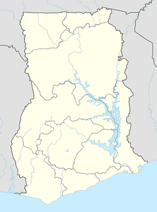
Location on the map of Ghana
Tamale
Liquor store
Clear's Winery And More
Dagomba Road, Tamale
Liquor store
read more
Meal takeaway
Cheff's Corner Chinese
Dagomba Road, Tamale
Meal takeaway
read more
Blue container
Tamale
Meal takeaway
read more
Bus station
Lorry Station
Tamale
Bus station
read more
OA Bus Terminal
Tamale
Bus station
read more
Kingdom Bus Station
Nyohini Road, Tamale
Bus station
read more
Tamale Metro Mass Transport Station
Tamale
Bus station
read more
STC Bus
Education Ridge Road, Tamale
Bus station
read more
Main Tro-Tro Station
Tamale
Bus station
read more
Pharmacy
Bankaman Pharmacy
Lamashegu-Builpela Road, Tamale
Pharmacy
read more
OPAC PHARMACY LTD
Hurlingham Street
Pharmacy
read more
Ricky Pharmacy
Bank Road, Tamale
Pharmacy
read more
Wumpini Agro Chemical
Tamale
Pharmacy
read more
Hajia Amina's Liciensed Chemical Shop
Tamale
Pharmacy
read more
wupini Warehouse
Tamale
Pharmacy
read more
Dokuluku Pharmaceutical Wholesalers
Tamale - Tolon Road, Tamale
Pharmacy
read more
Chamalt Pharmacy
Tamale
Pharmacy
read more
Chamalt Pharmacy
Ghana
Pharmacy
read more
Peekay Gombi Pharmacy
Ghana
Pharmacy
read more
Pharmacy Shop
Tamale
Pharmacy
read more
Mek Pharmacy Ltd.
Ghana
Pharmacy
read more
Procare Pharmacy Ltd
Jisonayili Road, Tamale
Pharmacy
read more
ARK CHEMICALS
Dagomba Road, Tamale
Pharmacy
read more
Medicare Pharmacy Ltd
Ghana
Pharmacy
read more
Place of worship
Lighthouse Chapel International, Tamale North
Tamale
Place of worship
read more
Catholic Mission Savelugu
Savelugu
Place of worship
read more
Gumani Kingdom Hall
9°26'26.9"N 0°50'09.0"W
Place of worship
read more
upci word aflame temple
Tamale - Techiman Road, Tamale
Place of worship
read more
Africa Islamic Economic Foundation
Lamashegu-Builpela Road, Tamale
Place of worship
read more
TTH Central Mosque
Tamale
Place of worship
read more
📑
Tamale all categories
Accounting
Administrative area level 2
Atm
Bakery
Bank
Bar
Beauty salon
Book store
Bus station
Cafe
Car dealer
Car rental
Car repair
Car wash
Cemetery
Church
Clothing store
Courthouse
Dentist
Doctor
Electronics store
Finance
Fire station
Florist
Food
Furniture store
Gas station
General contractor
Grocery or supermarket
Gym
Hair care
Hardware store
Health
Home goods store
Hospital
Insurance agency
Jewelry store
Laundry
Library
Liquor store
Local government office
Locality
Lodging
Meal takeaway
Mosque
Movie theater
Moving company
Natural feature
Neighborhood
Night club
Park
Parking
Pharmacy
Place of worship
Point of interest
Police
Post office
Premise
Real estate agency
Restaurant
Route
School
Shopping mall
Stadium
Storage
Store
Supermarket
Taxi stand
Travel agency
University
sublocality level 1
↑