Lodging nearby Saarland View Hotel
Ghana
Lodging nearby Saarland View Hotel
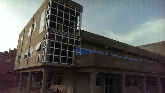
Saarland View Hotel
Behind Rocksters Roofing Company, Tantra Hill, Achimota, Ghana
contacts phone
:
+233
website:
travel.jumia.com
Latitude:
5.64758
, Longitude:
-0.254153
larger map & directions
read more
nearest Lodging
95 m
Tadomah Hotel
Ghana
Lodging
read more
467 m
Blue Diamond Hotel
Taifa, Dumas junction., Accra
Lodging
read more
528 m
Filly's Guest house
Off First Lane, Tantra Street, Accra
Lodging
read more
533 m
Alhaji Hotel
Cfc Estates, Taifa
Lodging
read more
730 m
Friendly Guest House
Taifa-Dumas Junction, Taifa
Lodging
read more
771 m
Gansevoort Hotel
Behind SSNIT Flat Building, Tantra Hills
Lodging
read more
820 m
Hotel de Blue Diamond
Just near to Daavi Book Store, Taifa
Lodging
read more
851 m
Queens Brigde Guest House
Taifa
Lodging
read more
1.028 km
Bronx View Hotel
Ginger Street, Accra
Lodging
read more
1.039 km
Golden Kan Hotel
East Ofankor, before the Ofankor Barrier, Accra
Lodging
read more
1.077 km
Blessed Hilltop Guest Lodge
Taifa, Accra
Lodging
read more
1.395 km
Bayous Court
Cfc Estates, Taifa
Lodging
read more
1.526 km
Achimota
125 tantra hills
Lodging
read more
1.539 km
Korint Hotel
off cemetery road, ofankor. Accra
Lodging
read more
1.571 km
TOPPERS GUEST HOUSE
Saint Johns - Dome - Kwabenya - Brekusu Road, Taifa
Lodging
read more
1.709 km
New city lodge
Taifa
Lodging
read more
1.815 km
Keegee Hotel
Alhaji Road, Accra
Lodging
read more
1.945 km
Zircon Hotel Gh
39A, Gye Nyame Street, Taifa
Lodging
read more
2.023 km
Sun Splash Hotel
Accra
Lodging
read more
2.121 km
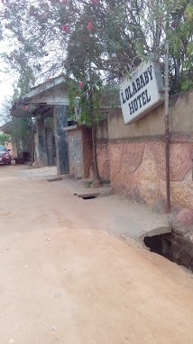
LOLA BABY HOTEL
Taifa
Lodging
read more
2.135 km
Hotel Mountain Guest Limited
Chantan T-Junction, New Achimota, Accra
Lodging
read more
2.146 km
Palm Plaza Bar and Restaurant
Ghana
Lodging
read more
2.199 km
Florensa Hotel
Chantan-Isreal, Achimota
Lodging
read more
2.317 km
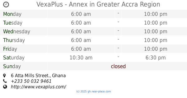
VexaPlus - Annex
6 Atta Mills Street.
Lodging
read more
2.502 km
Akwaaba Home
Saint Johns - Dome - Kwabenya - Brekusu Road, Adenkrebi
Lodging
read more
📑
all categories
Accounting
Administrative area level 1
Administrative area level 2
Airport
Amusement park
Aquarium
Art gallery
Atm
Bakery
Bank
Bar
Beauty salon
Bicycle store
Book store
Bus station
Cafe
Campground
Car dealer
Car rental
Car repair
Car wash
Casino
Cemetery
Church
City hall
Clothing store
Colloquial area
Convenience store
Courthouse
Dentist
Department store
Doctor
Electrician
Electronics store
Embassy
Finance
Fire station
Florist
Food
Funeral home
Furniture store
Gas station
General contractor
Grocery or supermarket
Gym
Hair care
Hardware store
Health
Hindu Temple
Home goods store
Hospital
Insurance agency
Intersection
Jewelry store
Laundry
Lawyer
Library
Liquor store
Local government office
Locality
Locksmith
Lodging
Meal delivery
Meal takeaway
Mosque
Movie rental
Movie theater
Moving company
Museum
Natural feature
Neighborhood
Night club
Painter
Park
Parking
Pet store
Pharmacy
Physiotherapist
Place of worship
Plumber
Point of interest
Police
Post office
Premise
Real estate agency
Restaurant
Roofing contractor
Route
Rv park, camping
School
Shoe store
Shopping mall
Spa
Stadium
Storage
Store
Subpremise
Subway station
Supermarket
Synagogue
Taxi stand
Train station
Transit station
Travel agency
University
Veterinary care
Zoo
sublocality level 1
↑