Lodging nearby Savita Lodge
Ghana
Lodging nearby Savita Lodge
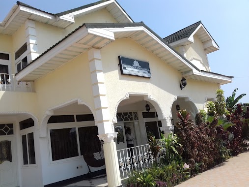
Savita Lodge
Ogbodjo, Ghana
contacts phone
:
+233 20 393 9373
website:
www.savitalodge.com
Latitude:
5.6716068
, Longitude:
-0.1520756
larger map & directions
read more
nearest Lodging
316 m
Adjogah Family
Emmanuel Villa, Boundary Road, Madina
Lodging
read more
359 m
Cheros Villa
63 Boundary Road, Madina
Lodging
read more
529 m
Bergmann Hostel
Madina
Lodging
read more
561 m
La Community Bank
Madina
Lodging
read more
571 m
Pink Panther Hotel
Hse No 80-8 Adenta, Adenta
Lodging
read more
663 m
Bheights Hotel
Madina
Lodging
read more
699 m
Executive 5 Bedroom House At East Legon
40 Boundary Road, Accra
Lodging
read more
743 m
Relaxation and comfort
South Boundry Road 186a, Madina
Lodging
read more
864 m
ILGS Hostel
Madina
Lodging
read more
916 m
Imperial Guest House
Madina
Lodging
read more
1.21 km
Castle More Lodge
Ako Loop, Madina
Lodging
read more
1.228 km
nabegyi geust house
abgobga
Lodging
read more
1.252 km
Shelter Hostel
Unnamed Road, Madina
Lodging
read more
1.354 km
Pilma hotel
Madina
Lodging
read more
1.367 km
Alpha Lodge
Madina, Maaye Hot, The Mama's Kitchen, Madina
Lodging
read more
1.518 km
Marisa Hotel, Madina Accra
Madina
Lodging
read more
1.544 km
Kingsbridge Royale Hotel
ARS Road,, Accra
Lodging
read more
1.609 km
Ultimate Hotel
New Bortianor, Weija, Accra
Lodging
read more
1.789 km
Green Hostel
Madina
Lodging
read more
1.853 km
Botchway Building
Ghana
Lodging
read more
2.046 km
Ritz Hotel Approx.
Agblezaa - Manet Road, Accra
Lodging
read more
2.108 km
Goodwill Plaza Hostel
Accra
Lodging
read more
2.157 km
Hedzorle Villa
Ashaley Botwe Old town Ashaley Botwe, Ashalebotwe
Lodging
read more
2.169 km
Lonnie's House
Lake Side Estates
Lodging
read more
2.256 km
Joy Hostel
Unnamed Road,, Accra
Lodging
read more
📑
all categories
Accounting
Administrative area level 1
Administrative area level 2
Airport
Amusement park
Aquarium
Art gallery
Atm
Bakery
Bank
Bar
Beauty salon
Bicycle store
Book store
Bus station
Cafe
Campground
Car dealer
Car rental
Car repair
Car wash
Casino
Cemetery
Church
City hall
Clothing store
Colloquial area
Convenience store
Courthouse
Dentist
Department store
Doctor
Electrician
Electronics store
Embassy
Finance
Fire station
Florist
Food
Funeral home
Furniture store
Gas station
General contractor
Grocery or supermarket
Gym
Hair care
Hardware store
Health
Hindu Temple
Home goods store
Hospital
Insurance agency
Intersection
Jewelry store
Laundry
Lawyer
Library
Liquor store
Local government office
Locality
Locksmith
Lodging
Meal delivery
Meal takeaway
Mosque
Movie rental
Movie theater
Moving company
Museum
Natural feature
Neighborhood
Night club
Painter
Park
Parking
Pet store
Pharmacy
Physiotherapist
Place of worship
Plumber
Point of interest
Police
Post office
Premise
Real estate agency
Restaurant
Roofing contractor
Route
Rv park, camping
School
Shoe store
Shopping mall
Spa
Stadium
Storage
Store
Subpremise
Subway station
Supermarket
Synagogue
Taxi stand
Train station
Transit station
Travel agency
University
Veterinary care
Zoo
sublocality level 1
↑