Church nearby Christ Embassy Dzorwulu
Ghana
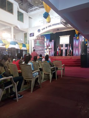
Church nearby Christ Embassy Dzorwulu
Christ Embassy Dzorwulu
Kpentenplebi Road, Accra, Accra Metropolis, GH Ghana
contacts phone
:
+233
Latitude:
5.6090395
, Longitude:
-0.2076865
larger map & directions
read more
nearest Church
146 m
Bethany methodist church
Accra
Church
read more
237 m
World Miracle Church
Blohum Road, Accra
Church
read more
245 m
Perez Chapel International
105 Olusegun Obasanjo Way, Accra
Church
read more
284 m
Triumph Centre A/G, Dzorwulu-Accra
Achimota Road, Accra
Church
read more
385 m
The Word Deliverance Chapel
Dzorwulu,Accra
Church
read more
432 m
Christco Church
Alajo, Accra
Church
read more
459 m
Baptist International Worship Centre
11 Yiyiwa Drive, Accra
Church
read more
561 m
St. Anthony's Anglican Church
Accra
Church
read more
577 m
ICGC Eden Temple
Kofi Dzata Street, Accra
Church
read more
594 m
Mission of Hope
Nii Kwabena Bonne Crescent, Accra
Church
read more
667 m
Deliverance Assemblies Of God Church
Kotobabi, Accra
Church
read more
718 m
Power Embassy International
Kotobabi, Accra
Church
read more
759 m
True Jesus Church
Ebony Crescent, Accra
Church
read more
826 m
Baptist International Worship Centre
Yiyiwa Drive, Accra
Church
read more
850 m
Deliverance Assemblies Of God Church, House Of Destiny
Kotobabi, Accra
Church
read more
883 m
Christian Praise International Centre
Accra
Church
read more
973 m
The Church of Pentecost
Accra
Church
read more
974 m
Abelemkpe Pentecost Church
Abelemkpe, Accra
Church
read more
983 m
Abelenkpe Methodist Church
Santana Road, Accra
Church
read more
1.002 km
Prevailing Christian Outreach Ministies
N1, Accra
Church
read more
1.064 km
Bisa Nyame Prayer Center
Accra
Church
read more
1.135 km
Alajo Church of Christ
Alajo, Accra
Church
read more
1.138 km
SouthernGate Chapel Int.
Alajo, Accra
Church
read more
1.157 km
Christian Divine Church Alajo
Alajo, Accra
Church
read more
1.223 km
NEW AGE BAPTIST CHURCH
KITE,, Achimota Road, Accra
Church
read more
📑
all categories
Accounting
Administrative area level 1
Administrative area level 2
Airport
Amusement park
Aquarium
Art gallery
Atm
Bakery
Bank
Bar
Beauty salon
Bicycle store
Book store
Bus station
Cafe
Campground
Car dealer
Car rental
Car repair
Car wash
Casino
Cemetery
Church
City hall
Clothing store
Colloquial area
Convenience store
Courthouse
Dentist
Department store
Doctor
Electrician
Electronics store
Embassy
Finance
Fire station
Florist
Food
Funeral home
Furniture store
Gas station
General contractor
Grocery or supermarket
Gym
Hair care
Hardware store
Health
Hindu Temple
Home goods store
Hospital
Insurance agency
Intersection
Jewelry store
Laundry
Lawyer
Library
Liquor store
Local government office
Locality
Locksmith
Lodging
Meal delivery
Meal takeaway
Mosque
Movie rental
Movie theater
Moving company
Museum
Natural feature
Neighborhood
Night club
Painter
Park
Parking
Pet store
Pharmacy
Physiotherapist
Place of worship
Plumber
Point of interest
Police
Post office
Premise
Real estate agency
Restaurant
Roofing contractor
Route
Rv park, camping
School
Shoe store
Shopping mall
Spa
Stadium
Storage
Store
Subpremise
Subway station
Supermarket
Synagogue
Taxi stand
Train station
Transit station
Travel agency
University
Veterinary care
Zoo
sublocality level 1
↑