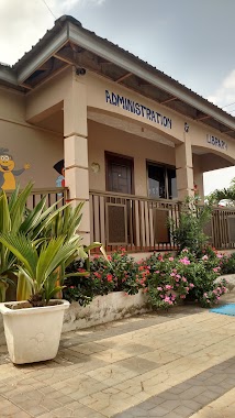
School nearby The Bridge of Hope
Ghana
School nearby The Bridge of Hope
The Bridge of Hope
Norwood City, Ghana
contacts phone
:
+233
Latitude:
5.6953034
, Longitude:
-0.1841587
larger map & directions
read more
nearest School
144 m
Science and Technology Education Centre (Sci Tech)
Ghana
School
read more
223 m
Opoku-Agyemang Sch.
Norwood City
School
read more
406 m
Sakora Bridge Of Hope School
Norwood City
School
read more
421 m
Global Theological Seminary
School
read more
574 m
Bernard Academy
School
read more
702 m
Kevboat Pre-School
Nii Kodia Road
School
read more
760 m
Comeva Montessori
Ga, East
School
read more
820 m
GLS (GOLDEN LEAP SCHOOL)
Hallelujah Broadway, Accra
School
read more
899 m
Nadat School
School
read more
913 m
Wass Primary
School
read more
931 m
The Light Academy, Adenta
Okpoti Street
School
read more
978 m
Maribea Kids School
House No. 12, Kristo Asafo Area, Adenta, Accra, Nyanyo Street
School
read more
1.026 km
Asda School
32 Nyanyo Street
School
read more
1.052 km
Hansmen Children's Centre
1046, Madina
School
read more
1.107 km
Eunicharles International School
School
read more
1.133 km
Danestrol Auto
113 Ecowas Road, Madina
School
read more
1.152 km
Ebenezer Mission Academy
Ghana
School
read more
1.232 km
Alma Montessori
School
read more
1.709 km
Phil Creche
Ghana
School
read more
2.06 km
Honey Pot Early Childhood Center
18 Adom street
School
read more
2.108 km
Golden Gate International School
Adenta Municipality
School
read more
2.161 km
Elim Cluster Of Schools
Madina
School
read more
2.285 km
Faith Community Baptist School
Madina
School
read more
2.325 km
Talent Restoration Academy
Madina
School
read more
2.396 km
Precious Jewels International School
Haatso
School
read more
📑
all categories
Accounting
Administrative area level 1
Administrative area level 2
Airport
Amusement park
Aquarium
Art gallery
Atm
Bakery
Bank
Bar
Beauty salon
Bicycle store
Book store
Bus station
Cafe
Campground
Car dealer
Car rental
Car repair
Car wash
Casino
Cemetery
Church
City hall
Clothing store
Colloquial area
Convenience store
Courthouse
Dentist
Department store
Doctor
Electrician
Electronics store
Embassy
Finance
Fire station
Florist
Food
Funeral home
Furniture store
Gas station
General contractor
Grocery or supermarket
Gym
Hair care
Hardware store
Health
Hindu Temple
Home goods store
Hospital
Insurance agency
Intersection
Jewelry store
Laundry
Lawyer
Library
Liquor store
Local government office
Locality
Locksmith
Lodging
Meal delivery
Meal takeaway
Mosque
Movie rental
Movie theater
Moving company
Museum
Natural feature
Neighborhood
Night club
Painter
Park
Parking
Pet store
Pharmacy
Physiotherapist
Place of worship
Plumber
Point of interest
Police
Post office
Premise
Real estate agency
Restaurant
Roofing contractor
Route
Rv park, camping
School
Shoe store
Shopping mall
Spa
Stadium
Storage
Store
Subpremise
Subway station
Supermarket
Synagogue
Taxi stand
Train station
Transit station
Travel agency
University
Veterinary care
Zoo
sublocality level 1
↑