Lodging nearby Hotel Feladei
Ghana
Lodging nearby Hotel Feladei
Hotel Feladei
Ghana Ghana
contacts phone
:
+233
Latitude:
5.6838697
, Longitude:
-0.1313535
read more
nearest Lodging
445 m
FBK Guest House
Madina Estate, Madina
Lodging
read more
467 m
Paradise Lodge
No. 23 Gold Street, Dome
Lodging
read more
740 m
Hedzorle Villa
Ashaley Botwe Old town Ashaley Botwe, Ashalebotwe
Lodging
read more
775 m
Benellacot Lodge
Unnamed Road, Madina
Lodging
read more
866 m
Lonnie's House
Lake Side Estates
Lodging
read more
979 m
Hostel Facility
Accra
Lodging
read more
1.291 km
Abroso Guest House
Unnamed Rd,, Madina
Lodging
read more
1.416 km
Shelter Hostel
Unnamed Road, Madina
Lodging
read more
1.418 km
Lakeside Place
Ghana
Lodging
read more
1.484 km
Bishop & Rev. Mrs. Anim-Yeboah
New Road, Ogbodjo
Lodging
read more
1.563 km
Botchway Building
Ghana
Lodging
read more
1.623 km
Villa Adjorkor
#26 Sowah Din Street, Nmai Dzorn Residential Area, next to Nmai Dzorn Police Station, Madina
Lodging
read more
1.704 km
Fa-semkye / New Ogbojo
old soldiers camp, fa-asemkye
Lodging
read more
1.727 km
Castle More Lodge
Ako Loop, Madina
Lodging
read more
1.746 km
Listaras Royal Hotel
Ogbodjo
Lodging
read more
1.801 km
X-Touch Guesthouse
Ogbodjo
Lodging
read more
1.866 km
Tulip Garden Hotel
East Legon, P 133/134 Hills Nanakrom, Accra
Lodging
read more
1.932 km
Oeso's Apartment By Petans
Lodging
read more
1.974 km
NTHC Prestige Estates
11 Cashew Link Road
Lodging
read more
1.981 km
J & A Guest House
Ghana
Lodging
read more
1.999 km
Japan motors last stop
Unnamed Road
Lodging
read more
2.129 km
Royal Crown Hotel
Trasacco Valley
Lodging
read more
2.59 km
Ako Loop,Adenta-Housing down
Ako Loop
Lodging
read more
2.653 km
Amalia's Sunrise Breakfast - ASB
Ayaben Street, Adenta Municipality
Lodging
read more
2.665 km
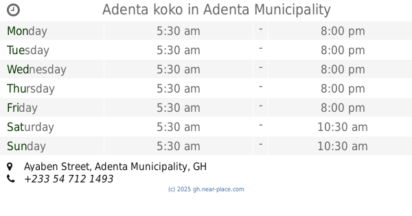
Adenta koko
58, Ayaben Street, Adenta Municipality
Lodging
read more
📑
all categories
Accounting
Administrative area level 1
Administrative area level 2
Airport
Amusement park
Aquarium
Art gallery
Atm
Bakery
Bank
Bar
Beauty salon
Bicycle store
Book store
Bus station
Cafe
Campground
Car dealer
Car rental
Car repair
Car wash
Casino
Cemetery
Church
City hall
Clothing store
Colloquial area
Convenience store
Courthouse
Dentist
Department store
Doctor
Electrician
Electronics store
Embassy
Finance
Fire station
Florist
Food
Funeral home
Furniture store
Gas station
General contractor
Grocery or supermarket
Gym
Hair care
Hardware store
Health
Hindu Temple
Home goods store
Hospital
Insurance agency
Intersection
Jewelry store
Laundry
Lawyer
Library
Liquor store
Local government office
Locality
Locksmith
Lodging
Meal delivery
Meal takeaway
Mosque
Movie rental
Movie theater
Moving company
Museum
Natural feature
Neighborhood
Night club
Painter
Park
Parking
Pet store
Pharmacy
Physiotherapist
Place of worship
Plumber
Point of interest
Police
Post office
Premise
Real estate agency
Restaurant
Roofing contractor
Route
Rv park, camping
School
Shoe store
Shopping mall
Spa
Stadium
Storage
Store
Subpremise
Subway station
Supermarket
Synagogue
Taxi stand
Train station
Transit station
Travel agency
University
Veterinary care
Zoo
sublocality level 1
↑