Lodging nearby Listaras Royal Hotel
Ghana
Lodging nearby Listaras Royal Hotel
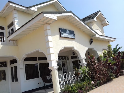
Listaras Royal Hotel
Ogbodjo Ghana
contacts phone
:
+233
Latitude:
5.6701084
, Longitude:
-0.1389502
read more
nearest Lodging
138 m
Fa-semkye / New Ogbojo
old soldiers camp, fa-asemkye
Lodging
read more
304 m
Castle More Lodge
Ako Loop, Madina
Lodging
read more
427 m
X-Touch Guesthouse
Ogbodjo
Lodging
read more
563 m
Bishop & Rev. Mrs. Anim-Yeboah
New Road, Ogbodjo
Lodging
read more
862 m
Shelter Hostel
Unnamed Road, Madina
Lodging
read more
1.304 km
Pink Panther Hotel
Hse No 80-8 Adenta, Adenta
Lodging
read more
1.375 km
Abroso Guest House
Unnamed Rd,, Madina
Lodging
read more
1.462 km
Savita Lodge
Ogbodjo
Lodging
read more
1.499 km
Executive 5 Bedroom House At East Legon
40 Boundary Road, Accra
Lodging
read more
1.504 km
Adjogah Family
Emmanuel Villa, Boundary Road, Madina
Lodging
read more
1.558 km
Hôtel Résidence De Séjour
Adjiringanor, Madina
Lodging
read more
1.657 km
Hedzorle Villa
Ashaley Botwe Old town Ashaley Botwe, Ashalebotwe
Lodging
read more
1.666 km
Bheights Hotel
Madina
Lodging
read more
1.687 km
NTHC Prestige Estates
11 Cashew Link Road
Lodging
read more
1.742 km
Ultimate Hotel
New Bortianor, Weija, Accra
Lodging
read more
1.746 km
Hotel Feladei
Ghana
Lodging
read more
1.747 km
La Community Bank
Madina
Lodging
read more
1.751 km
KCS Guest House
Ability Square, East Legon, Madina
Lodging
read more
1.77 km
Lonnie's House
Lake Side Estates
Lodging
read more
1.979 km
Botchway Building
Ghana
Lodging
read more
2.004 km
Cecelia Lodge
Adjiringanor, Madina
Lodging
read more
2.024 km
Kingsbridge Royale Hotel
ARS Road,, Accra
Lodging
read more
2.218 km
Pilma hotel
Madina
Lodging
read more
2.423 km
Alpha Lodge
Madina, Maaye Hot, The Mama's Kitchen, Madina
Lodging
read more
2.566 km
Bamboo House
149 E. Trasacco Road Adjiringanor
Lodging
read more
📑
all categories
Accounting
Administrative area level 1
Administrative area level 2
Airport
Amusement park
Aquarium
Art gallery
Atm
Bakery
Bank
Bar
Beauty salon
Bicycle store
Book store
Bus station
Cafe
Campground
Car dealer
Car rental
Car repair
Car wash
Casino
Cemetery
Church
City hall
Clothing store
Colloquial area
Convenience store
Courthouse
Dentist
Department store
Doctor
Electrician
Electronics store
Embassy
Finance
Fire station
Florist
Food
Funeral home
Furniture store
Gas station
General contractor
Grocery or supermarket
Gym
Hair care
Hardware store
Health
Hindu Temple
Home goods store
Hospital
Insurance agency
Intersection
Jewelry store
Laundry
Lawyer
Library
Liquor store
Local government office
Locality
Locksmith
Lodging
Meal delivery
Meal takeaway
Mosque
Movie rental
Movie theater
Moving company
Museum
Natural feature
Neighborhood
Night club
Painter
Park
Parking
Pet store
Pharmacy
Physiotherapist
Place of worship
Plumber
Point of interest
Police
Post office
Premise
Real estate agency
Restaurant
Roofing contractor
Route
Rv park, camping
School
Shoe store
Shopping mall
Spa
Stadium
Storage
Store
Subpremise
Subway station
Supermarket
Synagogue
Taxi stand
Train station
Transit station
Travel agency
University
Veterinary care
Zoo
sublocality level 1
↑